This page will be updated when more information becomes available. Last updated 8-9-2010: 10:45 am
Summary
The magnitude 7.1 earthquake occurred at 4:36 am on September 4, the epicentre was 40 km west of Christchurch city, and the depth of the quake was at 10 km. The epicentre was close to the town of Darfield. There was no tsunami resulting from this earthquake as it had occurred on land. It is the most damaging earthquake in New Zealand since the Hawke's Bay earthquake in 1931, but at this time there has been no loss of life. (Source: GeoNet website).
Images
Below is a small assortment of images taken by Virginia Toy, Dushan Jugum and Mark Quigley showing some of the effects of the earthquake. Click on any of the images to view fullsize in a new tab.
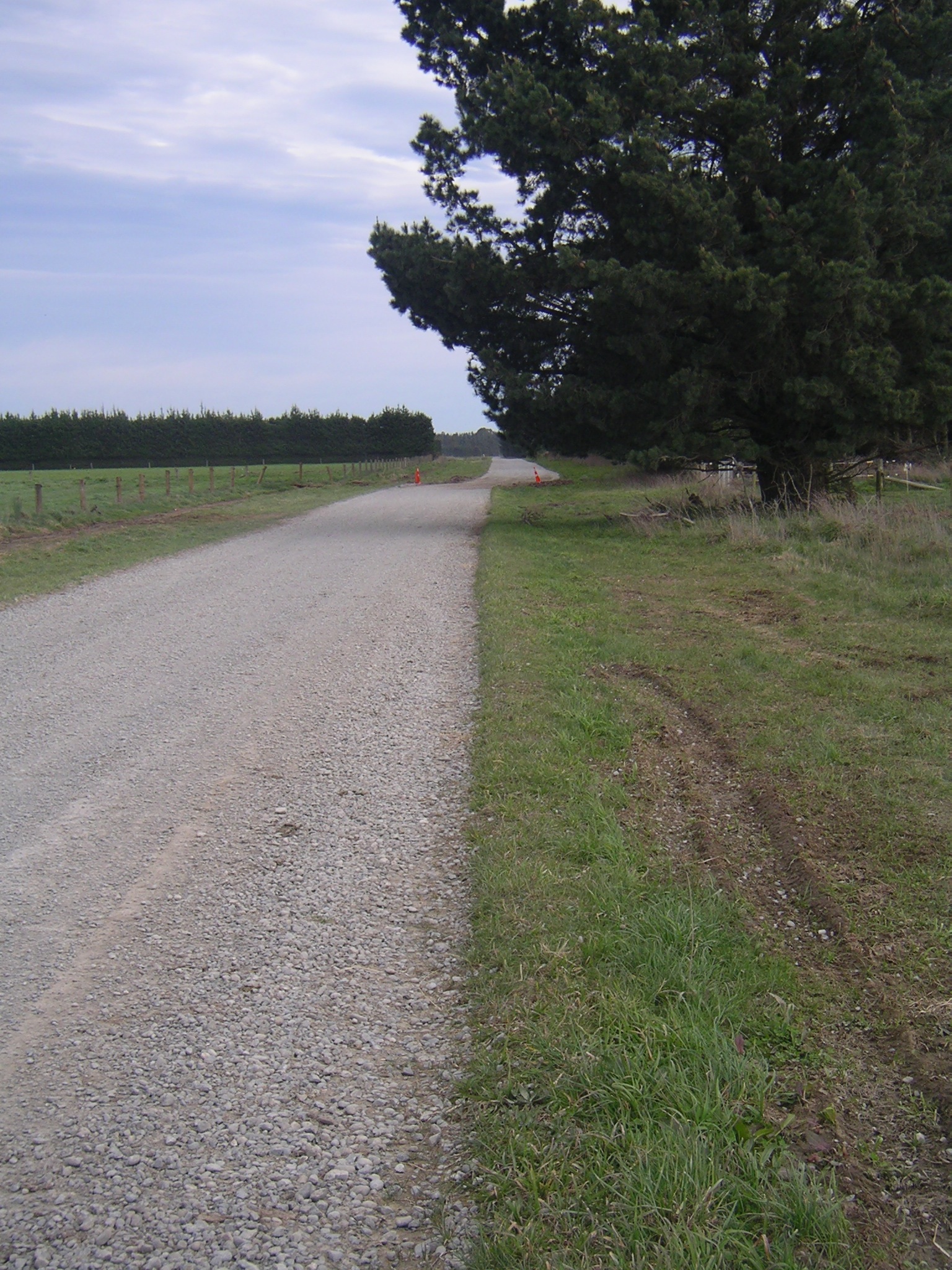
This country road on the Canterbury Plains has been offset a few metres in a dextral sense by slip on the fault that generated the earthquake.
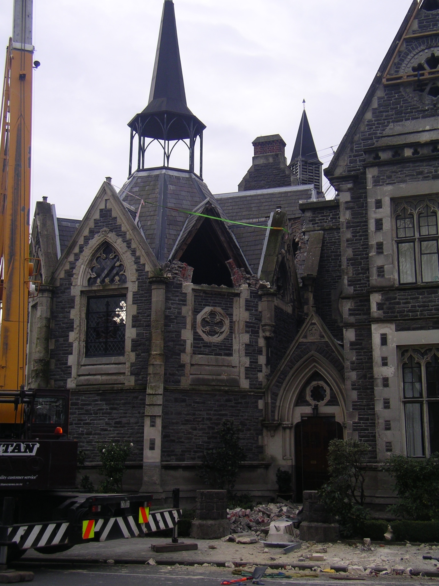
Damage to historic Christchurch buildings of similar style to the University of Otago Geology Department!
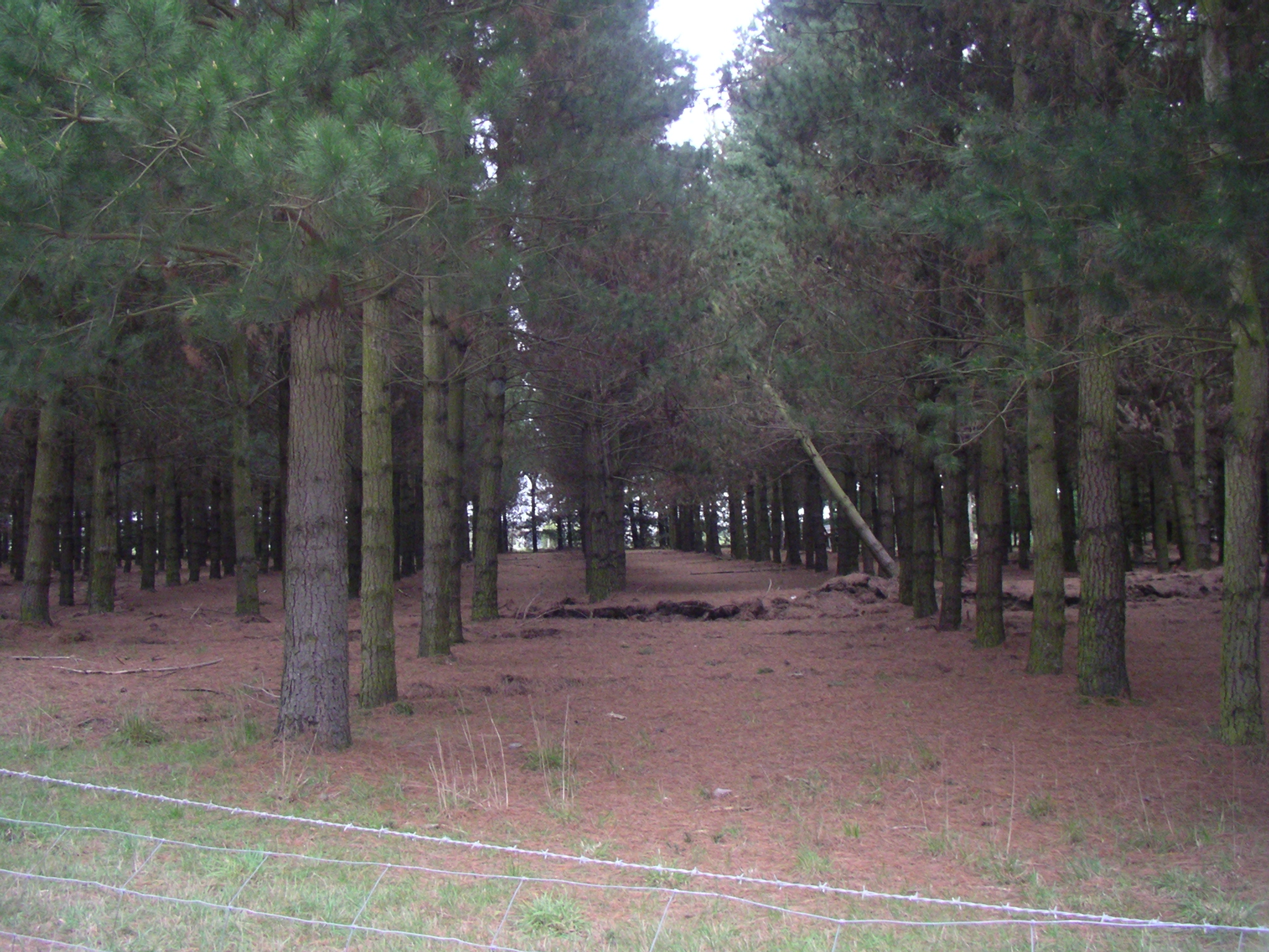
The fault also offset these rows of pine trees a few metres dextrally.
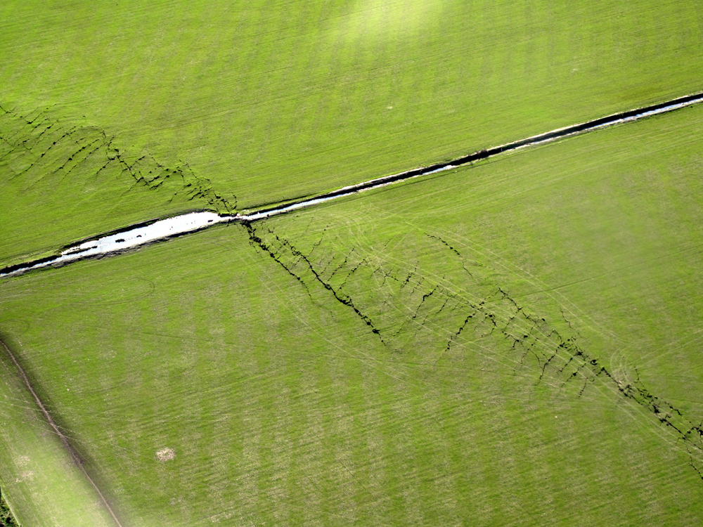
Photo of the fault from a helicopter the far side is downthrown slightly and offset to the right. Photo by Richard Jongens, GNS Science
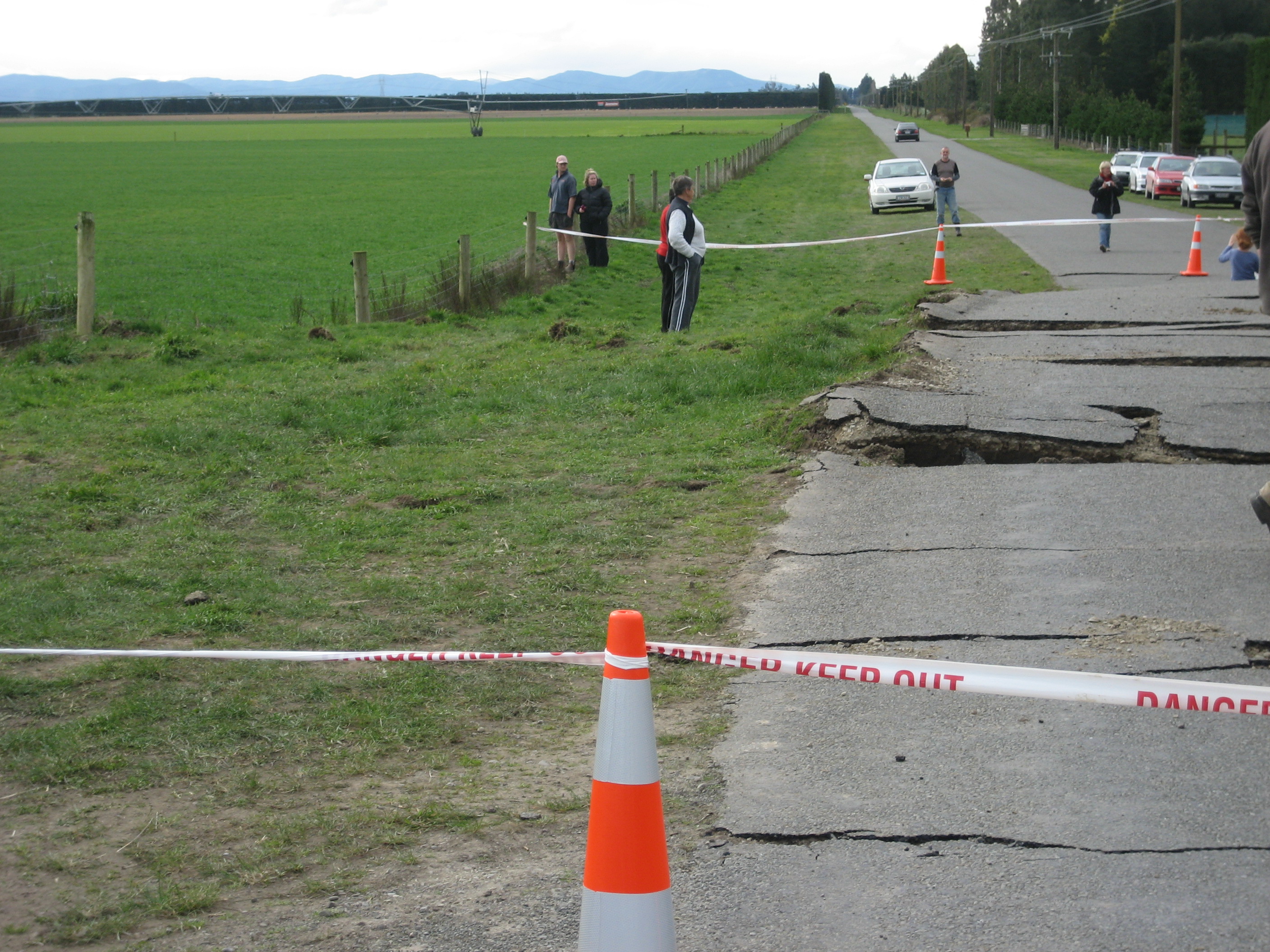
Cracked tarseal and uplift across the fault scarp as it crosses a road. This may be a restraining bend in the fault.
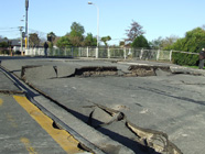
Cracked tarmac adjacent to a bridge in an area of Christchurch where ground shaking was probably amplified by local site soil effects. Photo by
Mark Quigley
, University of Canterbury.
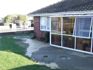
"Sand boils" adjacent to a house in Christchurch. These result from liquefaction of alluvial soils with shallow groundwater tables. Photo by
Mark Quigley
, University of Canterbury.
Earthquake shaking
The earthquake was felt quite extensively over much of the South Island and lower North Island (see the shaking maps from GeoNet). The seismometer housed in the Otago University Geology Department (in Dunedin) recorded the event and most of the subsequent aftershocks.
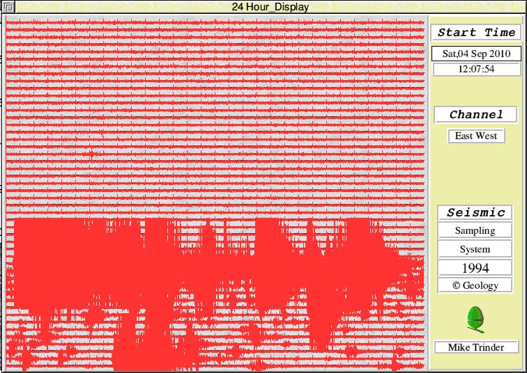
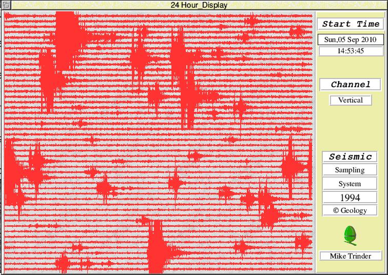
24 hour display from the Otago University Geology Department's seismometer. Each line across represents 30 min with vertical ticks at 1 min intervals. Start time shown on top right. Note the beginning of strong shaking on the bottom left of the picture relating to the magnitude 7.0-7.1 earthquake at Darfield (near Christchurch). Click on image to view full size.
24 hour display from the Otago University Geology Department's seismometer. Each line across represents 30 min with vertical ticks at 1 min intervals. Start time shown on top right. Note the aftershocks that have occured following the magnitude 7.0-7.1 earthquake at Darfield (near Christchurch). Click on image to view full size.
Links to other useful information
Local (Otago) news articles about the earthquake
This is a small list of articles from local (Otago) news outlets that have quoted University of Otago Geologists. Many of these articles stem from a seminar given in the Geology Department on 8/9/2010 by Virginia Toy (Otago) , Richard Norris (Otago), Richard Jongens (GNS Science) and Dushan Jugum (Otago) which attracted a lot of interest from the media and also the general public.
- http://www.odt.co.nz/campus/university-otago/124920/taieri-fault-lines-need-research
- http://www.ch9.co.nz/content/earthquake-hits-south-island
- http://www.stuff.co.nz/timaru-herald/news/4102419/Alpine-fault-biggest-risk
- http://www.ch9.co.nz/content/earthquake-provides-valuable-information-geologists
- http://www.odt.co.nz/news/national/125358/geologists-map-rupture
The Darfield Earthquake
- Watch a video montage along the fault trace from GNS Science
- Media release about the earthquake from GNS Science
- Information about the earthquake from Mark Quigley (University of Canterbury).
- News article about the earthquake from GeoNet website (a collaboration between GNS Science and the Earthquake Commission).
- Earthquake intensity maps compiled by 'felt it' reports submitted to GeoNet.
- Information about the earthquake from the USGS (United States Geological Survey)
- Latest news about the earthquake from Stuff
- Latest news from the NZ Herald
New Zealand seismicity and general information about earthquakes
- General information on NZ seismicity and other hazards in New Zealand on the GeoNet website.
- Check out information on our research pages about earthquakes in New Zealand. Includes some earthquake scenarios for the lower South Island.