High-frequency shallow marine seismology
The University of Otago is in an enviable geographical position for its access to shallow seas of outstanding geological interest. Within a transit of only a few hours, we study a range of diverse topics:
- The dynamic passive continental shelf of the eastern South Island that is affected by
- rapid sedimentation from the uplifting Southern Alps to the west,
- active structures related to the plate boundary,
- submarine fluid expulsion.
- An active shelf canyon system that rapidly descends from the continental shelf at water depths of about 150 m to the floor of the Bounty Trough at 1.5 km.
- The Campbell Plateau – a vast expanse of thinned and submerged continental crust off the east coast of the South Island.
A little farther away, we can reach other unique localities:
- Stewart Island
- Fiordland
- New Zealand's subantarctic islands.
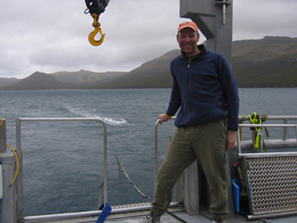 Andrew Gorman collecting Boomer seismic data aboard the RV Polaris II in Perseverance Harbour, Campbell Island.
The tools
The University of Otago's research vessel, Polaris II, has three main tools that can be used simultaneously for high-frequency seismic and acoustic imaging of the seafloor and the geology below. Our electro-acoustic sub-bottom profiler, or 'boomer', has been used by the department since the early 1990's to record single-channel analogue seismic data on the continental shelf and South Island lake floors. This is complemented by a modern 24-channel micro-eel receiver array from Geometrics that enables us to produce high-resolution stacked seismic images of the seafloor. Higher resolution sub-bottom imaging is done through a 1-10 kHz CHIRP sub-bottom profiler from Teledyne Benthos, and multibeam bathymetric mapping is undertaken by an R2Sonic multibeam echosounder. All three tools are recorded digitally and merged with location information from a variety of GNSS positioning systems on board.
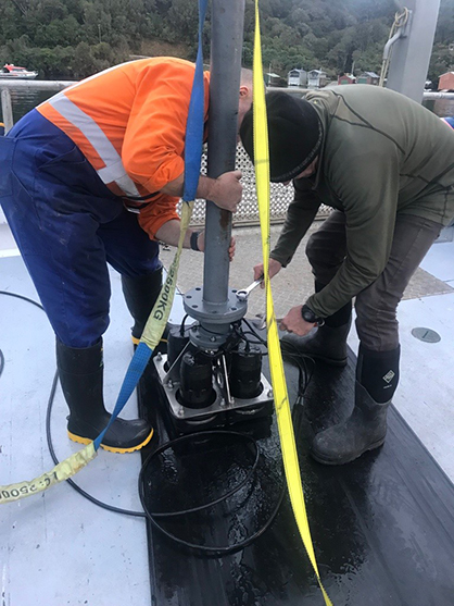 Preparing to mount the CHIRP sub-bottom profiler on RV Polaris II off the coast of Stewart Island.
Ongoing research
Many PhD, MSc and Honours research projects have made use of the controlled-source seismic and acoustic capabilities of our department since 1990. We also make use of the complementary capabilities of our collaborators (e.g., on board NIWA's RV Tangaroa). Here are some examples of research publications that highlight our work.
- Perkins EJ, Gorman AR, Tidey EJ, Wilson GS, Ohneiser C, Moy CM, Riesselman CR, Gilmer G, Ross BS 2020. High-resolution seismic imaging reveals infill history of a submerged Quaternary fjord system in the subantarctic Auckland Islands, New Zealand. Quaternary Research 93(1): 255-266.
- Hillman JIT, Klaucke I, Pecher I, Gorman AR, Schneider von Deimling J, Bialas J 2018. The influence of currents associated with the Subtropical Front upon seafloor depression morphologies. New Zealand Journal of Geology and Geophysics 61(1): 112-125.
- Hillman JI, Lamarche G, Pallentin A, Pecher IA, Gorman AR, Schneider von Deimling J 2018. Validation of automated supervised segmentation of multibeam backscatter data from the Chatham Rise, New Zealand. Marine Geophysical Research 39(1-2): 205-227.
- Barnes PM, Ghisetti FC, Gorman AR 2016. New insights into the tectonic inversion of North Canterbury and the structural context of the 2010-2011 Canterbury earthquake sequence, New Zealand. Geochemistry Geophysics Geosystems 17: 324-345.
- Barnes P, Pickrill R, Bostock H, Dlabola E, Gorman A, Wilson G 2016. Relict proglacial deltas in Bradshaw and George sounds, Fiordland, New Zealand. Geological Society, London, Memoirs 46(1): 91-92.
- Hillman JIT, Gorman AR, Pecher IA 2015. Geostatistical analysis of seafloor depressions on the southeast margin of New Zealand's South Island — Investigating the impact of dynamic near seafloor processes on geomorphology. Marine Geology 360(0): 70-83.
- Dlabola EK, Wilson GS, Gorman AR, Riesselman CR, Moy CM 2015. A post-glacial relative sea-level curve from Fiordland, New Zealand. Global and Planetary Change 131: 104-114.
- Gorman AR, Hill MG, Orpin AR, Koons PO, Norris RJ, Landis CA, Allan TMH, Johnstone T, Gray FL, Wilson D and others 2013. Quaternary shelf structures SE of the South Island, imaged by high-resolution seismic profiling. New Zealand Journal of Geology and Geophysics 56(2): 68-82.
- Osterberg EC 2006. Late Quaternary (marine isotope stages 6-1) seismic stratigraphic evolution of the Otago continental shelf, New Zealand. Marine Geology 229: 159-178.