 Tuesday 14 May 2013 2:18pm
Otago scientists are drilling deep, gaining a better understanding of the processes at work within the South Island's Alpine Fault and the impacts an earthquake is likely to have.

Dr Virginia Toy
Dr Virginia Toy's preferred workplace is deep in the South Westland rainforest, where she is co-leading an international investigation into New Zealand's unique Alpine Fault zone. Toy and Department of Geology colleagues are collaborating with researchers around the world to drill deep into the Earth's crust to learn more about earthquakes and the processes that cause them.
The Deep Fault Drilling Project is led by Toy, Dr Rupert Sunderland of GNS Science and Associate Professor John Townend of Victoria University. Support comes from other institutions in New Zealand and overseas, including the International Continental Scientific Drilling Programme (ICDP), a global scientific consortium investigating the Earth's crust.
The Alpine Fault is believed to rupture every 200 to 400 years in earthquakes with magnitudes of 7.9 or more. It last failed about 300 years ago, so scientists think another 'quake is coming, but no one knows exactly when.
The fault, a result of the Australian and Pacific tectonic plates colliding, is unusual in that the resulting rapid uplift of the Southern Alps has both exhumed rocks from deep in the Earth and also created a very shallow seismogenic – or earthquake-generating – zone.
For geologists like Toy, it's a researcher's paradise.
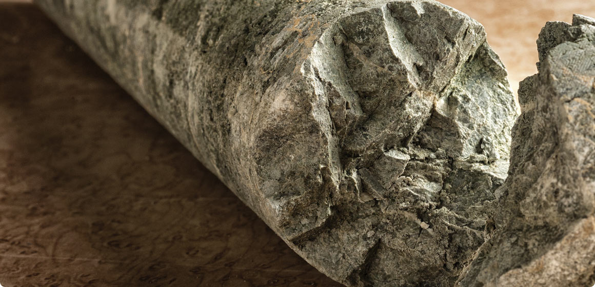
“It's brilliant that we have this unique outcrop where we can find rocks on the surface from as deep as 35 kilometres down in the shear zone that is the continuation of the fault below the seismogenic zone.
“Most of my research has involved fieldwork – it's where I'm happiest – but more recently I've become more involved in microscopy and experimental rock deformation. It's a long-winded process, but it gets results.”
Working with surface rocks is only part of the story and the drilling project is opening a new chapter. In 2011, pilot boreholes were drilled to about 100 and 150 metres, and now phase two of the project aims to drill to 1.5 kilometres to sample and monitor the fault.
“Drilling takes a whole lot of resources and time, and you only recover a small sample of what's down there compared with what you have on the surface – but there are three important reasons for doing it,” says Toy.
“First, drilling should give us more continuous sections through fault rocks, so we don't miss important structures.
“Second, examining rock conditions such as temperature, stress and strain rates near the surface is complicated by such things as circulation of rainwater to hundreds of metres depth, driven by the topographic head. You can't get accurate measurements, so the deeper you go the more likely you are to get away from near-surface effects and the more accurate your data.
“Finally, if we are to learn more about why earthquakes occur and under what conditions, you can't see that at the surface – you only see the end result. We need to investigate where they originate.
“The key is that ruptures do not start at the surface, but at an estimated five to eight kilometres down, so that's the area we need to know more about. Drilling gets us closer to the source of the event, so we can try to understand the initiation of earthquakes.”.
Earthquakes rupture along planar surfaces. The fault plane beneath the Southern Alps dips at about 45 degrees toward the southeast, underneath the high mountains.
“Earthquake ruptures affect an area of the fault plane about 300 kilometres long and up to 10 kilometres deep. The fault won't all slip at the same time. Instead, a rupture will gradually spread across the fault plane.”
Exploring the Alpine Fault's relatively shallow geological transitions should give a better understanding of the fundamental processes of rock deformation and how earthquakes are caused.
Toy hopes things will go smoothly. “This drilling project employs routine minerals' exploration industry techniques. It should be straightforward.”
That's more than can be said for another of Toy's recent projects, an offshore expedition to drill almost eight kilometres below sea level to investigate the causes of the tsunami that devastated Japan in 2011, killing almost 20,000 people. The drilling vessel's crew battled storms and extreme technical challenges to core about 850 metres into rock at the site of the magnitude 9 earthquake that triggered the tsunami.
“I spent two months off the coast of Japan on a research vessel. It was one of the most technically difficult drilling expeditions I have ever been on,” says Toy, “but the experience was very valuable.”
Learning is close to Toy's heart and she sees potential for using the Alpine Deep Fault Drilling Project as a teaching platform.
“The outreach possibilities of a project like this are huge. The German KTB borehole project established by the ICDP is used extensively for training purposes. As an education site, its one of the coolest outreach set-ups I have seen recently. It's regularly visited by school groups and used for geological and scientific drilling training.
“In New Zealand we're under-focused on national heritage sites, such as the Alpine Fault. We'd need buy-in from the Department of Conservation and to get science communicators involved, but we could create a long-term Alpine Fault-related site, not only for education, but even for tourists.”
Funding
- Marsden Fund
- International Continental Scientific Drilling Programme
- Institute of Geological and Nuclear Sciences
- Consortium of New Zealand Universities
- National Environmental Research Council (UK)
- German Research Foundation (DFG)
- National Science Foundation