“Photogrammetry consists of making precise measurements from photographs and other imaging sources to determine the relative locations of points in space”. American Society for Photogrammetry and Remote Sensing (ASPRS).
Photogrammetry is traditionally used to create topographic maps from aerial and spatial imagery. Close range photogrammetry is also used at the School of Surveying to obtain accurate measurements of animals in wildlife research or to create virtual models of historical buildings.
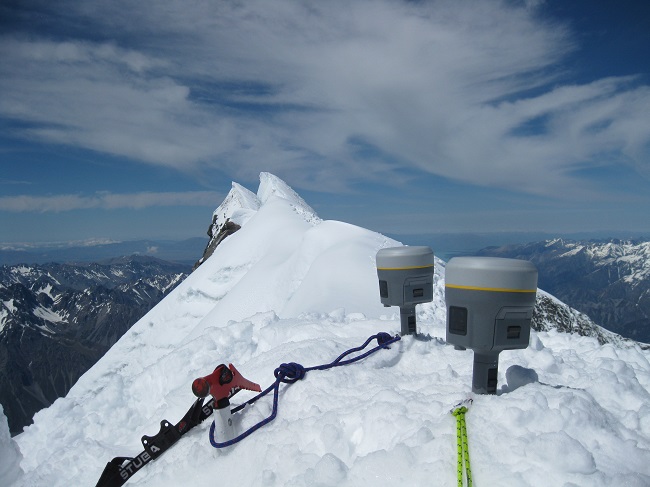 AORAKI2013, surveying the height of Aoraki/Mt Cook
More than 20 years after the summit of Aoraki/Mt Cook was affected by a spectacular rock avalanche, a team of surveyors and geographers led by Dr Pascal Sirguey engaged in a new survey to establish the height of this iconic landmark.
Find out more about the height of Aoraki/Mt Cook.
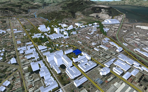 The virtual Dunedin
Fully digital aerial photography of Dunedin are processed using state of the art photogrammetric technologies to create a virtual model of Dunedin. This model can be used in research involving geovisualization or urban planning.
Find out more about the virtual Dunedin.
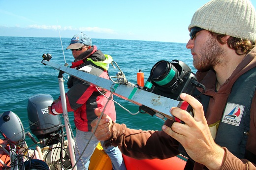 Photogrammetry for wildlife studies
Digital close range photogrammetric techniques are used to estimate the size of wild animals such as sperm whales from a distance.
Find out more about the determination of sperm whale size at sea.
Close range photogrammetry vs. laser scanning
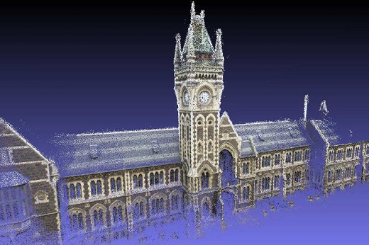
The School of Surveying in association with the Dunedin-based company Areograph and the Surveying firm Global Survey (New Zealand agent for Leica) conducts research to compare the performance of laser-scanning and an innovative automated web-based photogrammetry system.
Find out more about close range photogrammetry vs. laser scanning.