Edinburgh
Cabinet 18
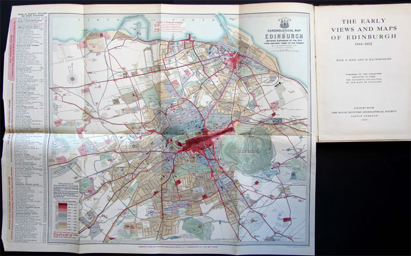
This Royal Geographical Society map shows the expansion of Edinburgh (Din Eidyn, a dun or hillfort; modern Scottish Gaelic ‘Dùn Eideann’) from earliest times to about 1919.
Edinburgh is the capital city of Scotland, the seat of the Scottish Parliament, the second largest city in Scotland, and the seventh-most populous in the United Kingdom (estimated in 2009 at 477,660).
The map not only alerts viewers to the divisions that make up ‘Auld Reekie’ (New Town, Old Town), but it also reveals name similarities, especially in the city, to Dunedin, the ‘Athens of the South’: Heriot Row, and streets Great King, Hanover, George, Princes, and Cumberland.
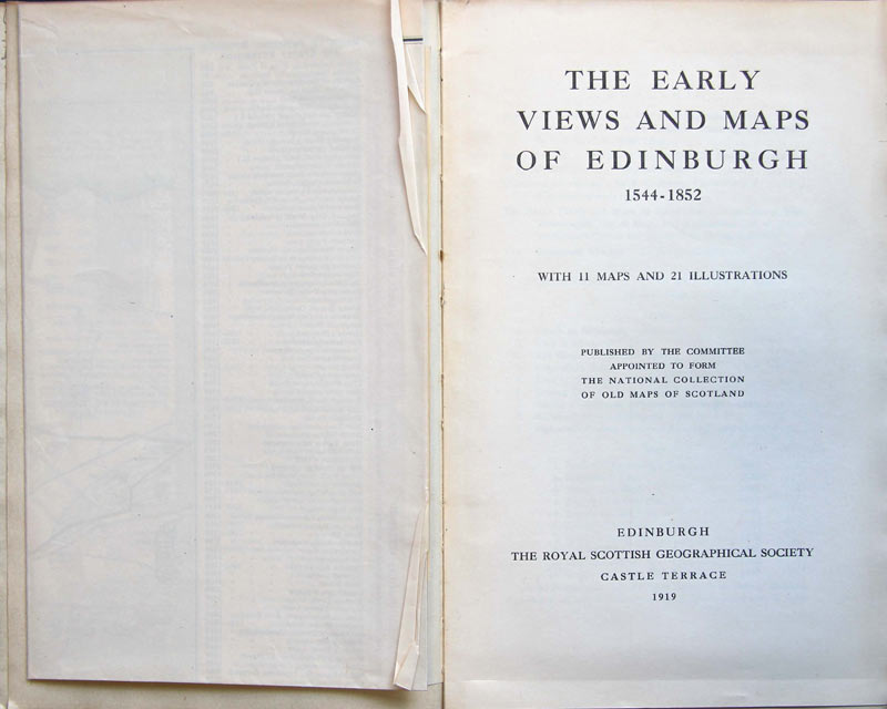
Royal Scottish Geographical Society, The Early Views and Maps of Edinburgh, 1544-1852. Edinburgh: The Royal Scottish Geographical Society, 1919.