 Monday 3 April 2017 1:10pm
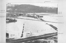
Our response to sea-level rise affecting South Dunedin should not wait until the science is settled, the University of Otago's Centre for Sustainability says.
To help with that response, the Centre's researchers have compiled a multi-layered database with superimposed maps.
Put together by summer scholarship student Leigh McKenzie, the database features more than 140 digital layers of information about the at-risk part of greater South Dunedin, including flood hazards, modelled water ponding under different scenarios, house ages and demographic details from the New Zealand Census.
By superimposing these digital maps, agencies can more quickly understand the impacts of sea-level rise or flooding in the vulnerable area on residents, community facilities and infrastructure.
“Even without any detailed analysis, you start to see some interesting things,” Ms McKenzie says.
“For example, the biggest area that is less than one metre above sea-level is around St Kilda East, but the areas most subject to ponding are mainly around Forbury and St Kilda West.
“There are a number of schools and rest homes in these areas, so immediately you start to think about the impacts on young and old.”
Ms McKenzie, a Master of Science student, used ArcG software to create the database, working with Centre Director Dr Janet Stephenson, Deputy Director Dr Caroline Orchiston and Associate Professor Antoni Moore of the School of Surveying.
The main database requires specialist software to use but a simpler version for the public is available.
Dr Orchiston says the centre has been keen to pursue the work since late 2015, when Parliamentary Commissioner for the Environment, Dr Jan Wright, pinpointed South Dunedin as New Zealand's most vulnerable urban area to sea-level rise.
“The spatial database is an important step because it brings together information from many different agencies and holds it all in one place.”
Dr Stephenson says asking how much sea-level may rise and how soon is important.
“But it shouldn't overshadow the human side of the question, which is, 'who may be affected and how should we respond?'.”
Third-year climatology students at the University will be among the first users of the database.
Department of Geography Associate Professor Nicolas Cullen says South Dunedin's low-lying topography, shallow water table and strong connectivity between sea and groundwater make it highly vulnerable to flooding.
“We want to find out how often major flooding events can be expected to occur in future and also how smaller rainfalls affect groundwater.”
The students will analyse rainfall and groundwater records to see how they are correlated with floods.
The database has been a collaboration between the University, the Dunedin City Council (DCC) and the Otago Regional Council (ORC).
DCC Manager of Events and Community Development, Joy Gunn, says the spatial data collated by the Centre provides a “thorough and really valuable picture of the area”.
“The information will be very useful for the South Dunedin Stakeholder Group, of which the DCC is a member, as it looks at community development initiatives which support community and economic resilience, and community response planning.”
ORC Director of Science, Hazards and Engineering, Dr Gavin Palmer, agreed the data would add to the existing body of knowledge on South Dunedin.
“We are working to identify options for ways the community can adapt to South Dunedin's changing environment, now and for the future.
“This will be a useful dataset to help inform planning so we can respond to the changes in a coordinated and considered way with the community.”
For more information, please contact:
Dr Janet Stephenson
Centre for Sustainability, University of Otago
Tel: 03 479 8779
Email: janet.stephenson@otago.ac.nz
A list of Otago experts available for media comment is available elsewhere on this website.
Electronic addresses (including email accounts, instant messaging services, or telephone accounts) published on this page are for the sole purpose of contact with the individuals concerned, in their capacity as officers, employees or students of the University of Otago, or their respective organisation. Publication of any such electronic address is not to be taken as consent to receive unsolicited commercial electronic messages by the address holder.