BSc(Hons) (Portsmouth), MSc(Leicester), PhD (Plymouth)
Email: tony.moore@otago.ac.nz
Phone: +64 (0)3 479 7589
Room: Surveying building, 1st floor, Room 130
Profile
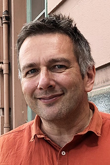
Antoni is a Professor in Geographical Information Science at the School, is the current dean and director of the Geographical Information Systems (GIS) degrees (BSc, MAppSc, MSc). He was previously in the Department of Information Science from 2001 to 2008 and before that working as a coastal / marine GIS Analyst at Plymouth Marine Laboratory in the UK. He has research interests in geovisualisation and cartography. He completed his BSc in Geographical Science in 1993, an MSc in GIS in 1994 and his PhD (on the application of holistic expert systems to integrated coastal zone management) in 2001.
Teaching
- SURV 208 Introduction to Geographical Information Systems (contributor; SURV 220 Geographic Information Science from 2024 onwards)
- SURV 319/SURV 519 Spatial Algorithms and Programming (coordinator)
- SURV 411/SURV 511 Spatial Analysis and Modelling (contributor)
- SURV 412/SURV 512 Geovisualization and Cartography (coordinator)
Research Interests
Geographical Information Science, particularly geovisualisation and cartography
- Visualization in space and time, including diagrams of complex trajectories, time geography-based displays and representation of uncertainty
- Geospatial Interfaces, including Geographic Augmented Reality (e.g. tangible sandbox interface to terrain data) and Geographic Virtual Environments
- Investigating artistic representations for space-time data (comic strips), Big Data (fractals) and interfaces (hybrid art-maps)
- Application of geovisual analytics and /or spatial analysis to geographic data (e.g. coastal applications including financial risk due to sea level rise, crime, agroecology, health)
- Cognition and spatial data display, cognitive maps, metaphors and spatialisations
- Computational approaches to cartography, including multi-scale model-based generalisation (circle tree) and use of allied technologies such as agents and expert systems
Research Themes (Disciplines)
- Geospatial Sciences (GIS, Remote Sensing, Photogrammetry)
Projects
Current projects
- Financial risk due to Sea Level Rise (STRAND - Marsden-funded project with Economics, Griffith University, GNS, Bodeker Scientific)
- Cartography and Art
- Geographic content analysis of WWI cartoons (with RMIT University)
- Active Transport to Schools (BEATS Study)
Completed projects
- Augmented Reality Sandbox for geospatial education (with HEDC, Dept. Computer Science, Dept. Information Science)
- Spatial analysis for agroecology on traditionally managed farms (with Future Farms Unit, Lincoln)
- Isotopic Variability of Rainfall across New Zealand (Department of Chemistry (Otago) and Oritain Ltd)
- Web-based visualization of volunteered crime data (University of Fortaleza, Brazil - Mestrado em Informatica Aplicada)
- Local and scientific knowledge integration for small scale fisheries
- Development of an Augmented Reality Street Map (Middlesex University, UK, Canterbury University (HitLabNZ), Department of Information Science (Otago))
- Hierarchical Hexagonal Surface Models
Supervision
Current Research Students
- Songxing Ma, MAppSc, (2023- ) Regional-style Non-Photorealistic Rendering for 3D Urban Models (primary supervisor)
- Ronny Rowe, MSc, (2022- ) Future Vision: A Cognitively Inspired Geographic Narrative Environment for Future Thinking and Decision Making, (primary supervisor)
- Ryan Easton, PhD, (2021- ) Fish passage remediation effects on fish movement and river connectivity (secondary supervisor, with Zoology, Information Science and Anatomy)
- Frances Ifeoma Ukonze, PhD, (2020 - ). Integrating green infrastructure as an adaptation tool for climate change in sustainable land transport development (co-supervisor with VUW and Surveying)
- Long Chen, PhD, (2017-2023, under examination) Spatial Analysis and Visualisation for Active Transport, (primary supervisor, with Geography)
- Vilimone Raqona, MAppSc, (2017-) Using GIS to Explore Enrolment Issues in Health Care, (primary supervisor, with Department of General Practice and Rural Health, and WellSouth)
- Rosee Hodgson, PhD, (2016-) A Right to Thrive: Voices of Marginalised Youth and the Implications for our Cities, (secondary supervisor, with Preventive and Social Medicine)
Recent Research Students
- Mohammed Lutfur Rahman, PhD, The Relationship of School Neighbourhood and Built Environment to Adolescents' Walking and Cycling to School, 2023, (primary supervisor, with AUT)
- Saeed Rahimi, PhD, Agents of Movement: Intelligence in Space-Time from Mapping to Causality, 2021, (primary supervisor, with Information Science)
- Liam McElwain, BSurv Hons, Analysing the Geospatial Differences between Japanese and American Comics, 2021, (secondary supervisor)
- Joseph Wright, PhD, Flow Direction Algorithms for Urbanised Catchment Mapping, 2019, (secondary supervisor)
- Tessa Pocock, MPhEd, School Neighbourhood Environment and Active Travel to Secondary Schools in Dunedin, NZ, 2018, (secondary supervisor, with School of Physical Education, Sport and Exercise Science)
- Sisi Zhang, MAppSc, Usability of online virtual reality for urban design, 2018, (primary supervisor)
- Kambiz Borna, PhD, Application of vector agents to object-based classification in remote sensing, 2017, (primary supervisor)
- Judy Rodda, PhD, Spatial analysis of Hector's dolphins in Te Wae Wae Bay, 2016, (primary supervisor, with Zoology)
- Alex Pasco, MAppSc, A GIS-based underground utility system for Dunedin International Airport, 2016, (primary supervisor)
Responsibilities
University
- Dean, School of Surveying (2023- )
- Director of the BSc (formerly BAppSc), PGDipAppSci and MAppSc courses in Geographical Information Systems (GIS)
School
- Member, Research and Postgraduate Committee
Professional Activities
Awards and Achievements
- Keynote at GeoCart 2022, the 10th National Cartographic Conference, National Library, Wellington
- UoO Research Group Award, as part of the Built Environment and Active Transport to School (BEATS) study team, 2019
- Won the Education and Professional New Zealand Spatial Excellence Award (NZSEA), 2016
- Won best poster at Conference for Spatial Information Theory (COSIT 2013), UK, 2013
Positions and Professional Responsibilities
- New Zealand Cartographic Society (NZCS), President 2022 - (Vice President 2018 - 2022; Secretary 2008-2018)
- Co-organiser of the GeoComputation 2019 international conference in Queenstown and (with NZCS committee) of GeoCart (2008-2022, biennial), the national cartographic conference
- Member of the International Cartographic Association (ICA) commissions on Visual Analytics (2008- ) and Geospatial Analysis and Modelling (2006- )
Editorial/Refereeing
- Editorial board of International Journal of Geographical Information Science, Transactions in GIS, International Journal of Cartography, Frontiers in Visual Communication and ISPRS International Journal of Geo-information.
News
- I'll be presenting at the 31st International Cartographic Conference 2023 in Cape Town, 13th-18th August (on "Uncertainty in Mapping Climate Change-Related Flooding Risk to Residential Property Values" with the STRAND Marsden team and "From the abstract to maps and landscapes: a metageovisualisation perspective")
- Study Geographical Information Systems at Otago!
- GeoComputation 2019 comes to New Zealand! Join us in Queenstown, 18th to 21st September 2019
- I'll be presenting at the 29th International Cartographic Conference 2019 in Tokyo, 15th-19th July (on "Multivariate thematic mapping using fractal glyphs" with Bin Jiang, University of Gavle)
Publications
Rahimi, S., Moore, A. B., & Whigham, P. A. (2022). A vector-agent approach to (spatiotemporal) movement modelling and reasoning. Scientific Reports, 12(1), 21179. doi: 10.1038/s41598-022-22056-9 Journal - Research Article
Smith, M. J., Otto, J.-C., Moore, A. B., Grohmann, C. H., Hillier, J., & Geilhausen, M. (2022). Geovisualization. In M. P. Bishop & J. R. Giardino (Eds.), Technology-driven geomorphology: Geospatial data science: Treatise on geomorphology (Vol. 1). (2nd ed.) (pp. 319-361). Academic Press. doi: 10.1016/B978-0-12-818234-5.00147-4 Chapter in Book - Research
Nguyen, Q., Thorsnes, P., Diaz-Rainey, I., Moore, A., Cox, S., & Stirk-Wang, L. (2022). Price recovery after the flood: Risk to residential property values from climate change-related flooding. Australian Journal of Agricultural & Resource Economics, 66, 532-560. doi: 10.1111/1467-8489.12471 Journal - Research Article
Chen, L., Moore, A. B., & Mandic, S. (2021). Using exploratory spatial analysis to understand the patterns of adolescents’ active transport to school and contributory factors. International Journal of Geo-Information, 10(8), 495. doi: 10.3390/ijgi10080495 Journal - Research Article
Rahman, M. L., Moore, A. B., & Mandic, S. (2022). Adolescents' perceptions of school neighbourhood built environment for walking and cycling to school. Transportation Research Part F, 88, 111-121. doi: 10.1016/j.trf.2022.05.011 Journal - Research Article
