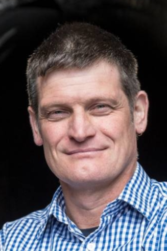
BSurv (Otago), MNZIS, RPSurv, LCS
Email: Richard.hemi@otago.ac.nz
Phone: +64 (0)3 479 7595
Room: Surveying building. 1st Floor, Room 121b
Profile
Richard graduated from the University of Otago with a BSurv in 1988 and worked as a graduate for three years in private practice in Nelson. In 1991, he completed his professional registration before heading to the UK for two years, working on large construction sites and highway design projects. On his return to NZ Richard joined Cato Bolam Consultants in Auckland, becoming a company director in 1998. During this time his work involved subdivision and land development projects as well as the day-to-day management of a large survey consultancy. Richard joined the School of Surveying at the beginning of 2008 and is currently teaching cadastral studies and engineering surveying. His areas of interest include urban design, cadastral surveying, land development engineering, and construction surveying. Richard has been involved in a number of research projects, most notably laser scanning heritage sites in Arras France, Micronesia and on Rekohu (the Chatham Islands). He is the Tertiary Representative on the S+SNZ Council, a S+SNZ Cadastral Stream committee member and is also serving on the LINZ STEP (Survey and Title Enhancement program) Survey working group. Richard is also in charge of the school's marketing and outreach program.
Teaching
- SURV307 Cadastral Surveying 2
- SURV457 Advanced Cadastral Studies
- SURV459 Engineering Surveying
- SURV298 Introductory Field Camp
Research and Professional interests
- Terrestrial Laser scanning
- Surveying for archaeological preservation and discovery
- Urban Design, Low-impact Design and Sustainability
- Engineering Construction
- Mining surveying
Some Projects
- LiDARRAS, Digging into our history, Surveying our heritage – WWI tunnels complex, Arras, France
- Rekohu (Chatham Islands), Dendroglyoph and Petroglyph scanning projects
- Nan Madol ruins, Federated states of Micronesia, scan project Anthropology Department
Responsibilities
University
- Hands-on at Otago Committee member (2010-present)
School
- School of Surveying outreach and recruitment representative
- Chair of the Survey School Marketing Committee (2015-present)
- School of Surveying Undergraduate Committee (2017-present)
Professional Activities
- Tertiary Representative, S+SNZ Council (NZ Institute of Surveyors)
- Member of the S+SNZ Cadastral stream committee
- Member S+SNZ STEP (Survey and Title Enhancement program - LINZ) Survey working group
Publications
- McCoy, M., Alderson,H.,Hemi, R., Cheng,H., Edwards, R. (2016) Earliest direct evidence of monument building at the archaeological site of Nan Madol (Pohnpei, Micronesia) identified using 230Th/U coral dating and geochemical sourcing of megalithic architectural stone. Quaternary Research
- Hemi R.(2016). Cadastral surveying teaching, School of Surveying. SurveyQuarterly
- Strack, M (ed), (2013). Survey Marks: Hemi, R. Laser Scanning: Recording History. School of Surveying
- Hemi R.(2012). Student urban design project review. SurveyQuarterly
- Barber I., Maxwell J., Hemi R., (2012) Growing Images: Creating surface scans and archaeological knowledge of Moriori carved trees on the Chatham Islands: International Conference on Easter Island and the Pacific- Conference proceedings
