Mapping snowdepth on the Main Divide with Pléiades satellite.
Collaboration with Yves Bühler from WSL-SLF on snow depth retrieval with Pléiades.
Collaboration with NZ Mountain Safety Council on analysing and visualising historic avalanche incidents.
Near real-time tracking of snow covered areas across the South Island with MODIS.
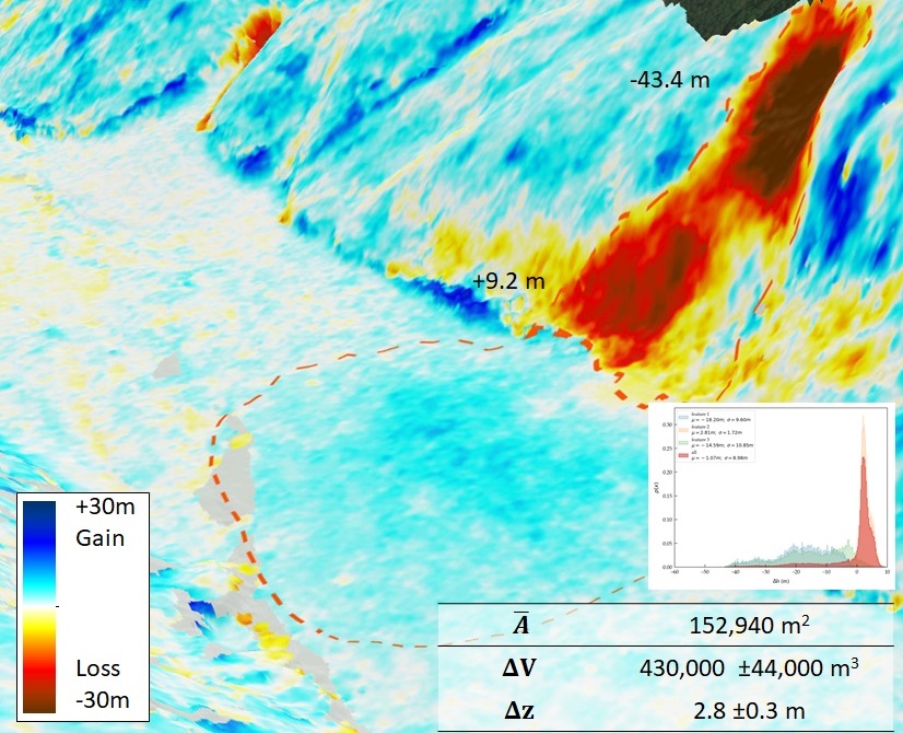
Environmental monitoring with 3D-change detection.
Topographic mapping of Franz Josef glacier with Pléiades.
Mapping of Kilimanjaro glaciers with Pléiades.
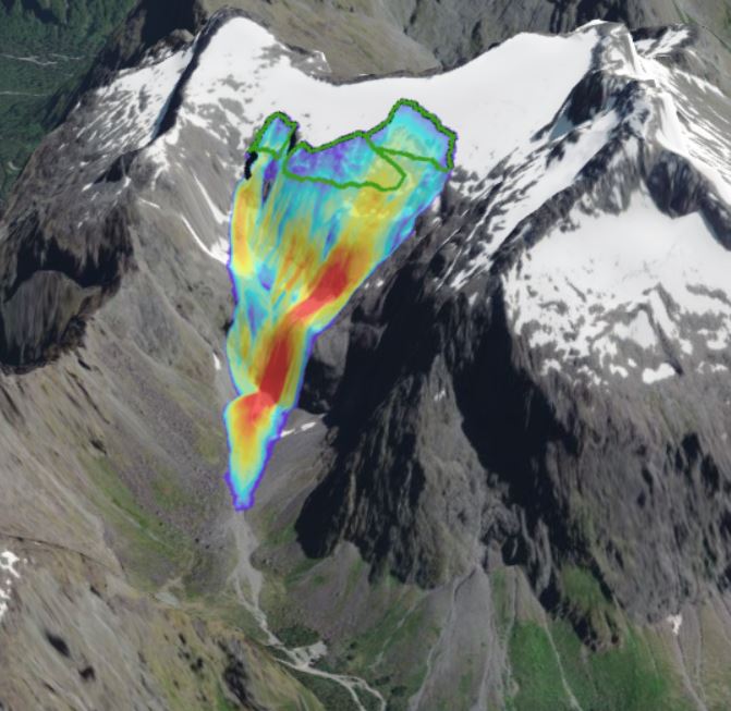
WebGIS with modelling results from McPherson Path.
Quarantine Island, Dunedin (NZ), Visualisation of Trimble UX5 drone photogrammetry model (19/9/2016), © University of Otago (2016).
Maitland River, Dunedin (NZ), Visualisation of Trimble UX5 drone photogrammetry model (18/9/2018), © University of Otago (2018).