The Avalanche Hazards Project
Snow avalanche hazards in Aotearoa New Zealand: Using extreme events from the past to plan for the future
With relatively sparse observational records in NZ compared with alpine regions in some northern hemisphere countries, investigation is needed on avalanche dynamics to support extreme-event planning and preparedness. This project will leverage the latest advances in geospatial science, including ongoing efforts to measure alpine topography with satellites (Matariki Project at Otago) and the remote sensing of snow avalanches (research at WSL-SLF in Switzerland), to calibrate dynamic models and simulate extreme avalanche events in NZ.
Uncertainty around possible changes to avalanche frequency and magnitude from climate change poses challenges to avalanche preparedness. This project will link past events with future climate scenarios to simulate possible effects on extreme avalanche events in NZ.
Tools and approach
Our team’s experience with the latest in satellite-based photogrammetry will be used to generate terrain models for alpine areas in NZ where no previous high-resolution terrain information is available. Terrain models will be used by geospatial modelling systems, including RApid Mass Movements (RAMMS), for path-specific avalanche simulations as well as landscape-scale avalanche hazard indication mapping.
 Example RAMMS simulation for Queenstown region, here depicting simulated core flow velocity from an extreme event.
Project outputs will be produced in collaboration with a range of project partners for snow avalanche planning and preparedness. NZ’s unique topography will also be used to improve hazard models for use internationally.
Project themes
| Avalanche dynamics | Topographic drivers | Past and future climate |
|---|---|---|
 |
 |
 |
| Refine avalanche simulations for Milford Road using high-resolution topographic, weather and avalanche flow characteristics. | Investigate effects of 3D topographic change on avalanche dynamics and establish release frequency for high-risk avalanche paths in Aoraki Mount Cook National Park. | Link RAMMS extreme event simulations with past climate and future climate scenarios in the Craigieburn Range. |
Team: Aubrey Miller, Pascal Sirguey, Nicolas Cullen (University of Otago), Yves Bühler, Perry Bartelt (WSL-SLF)
Some recent work
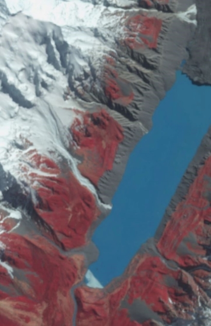
Characterizing the historic July 2022 mass movement sequence in Aoraki Mount Cook National Park
A record-breaking rain event 18-19 July 2022 induced a widespread snow avalanche and debris flow cycle in Aoraki Mount Cook National Park. With partners at the Department of Conservation and NIWA we documented the storm and subsequent mass movements in the Kitchener avalanche path adjacent to Mount Cook Village. This storm was unique in the amount of rain that was brought to high elevations (over 2000m) and fell on an above-average snowpack. Our event documentation and numerical modelling provide insight into the hazards posed by extreme rain falling on mid-winter snowpacks. See our paper in Geophysical Research Letters (Miller et al., 2023) and explore the results of our analysis in the Kitchener path in a webGIS below. Photo credit: Department of Conservation.
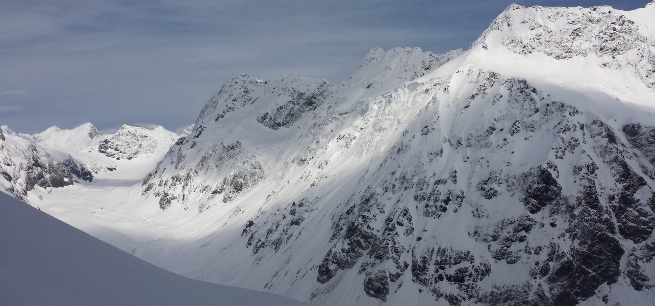
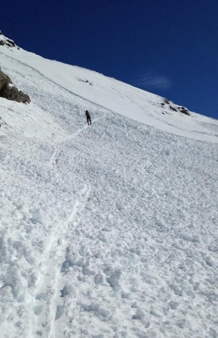
Establishing frequency and magnitude of snow avalanches in Aoraki Mount Cook National Park
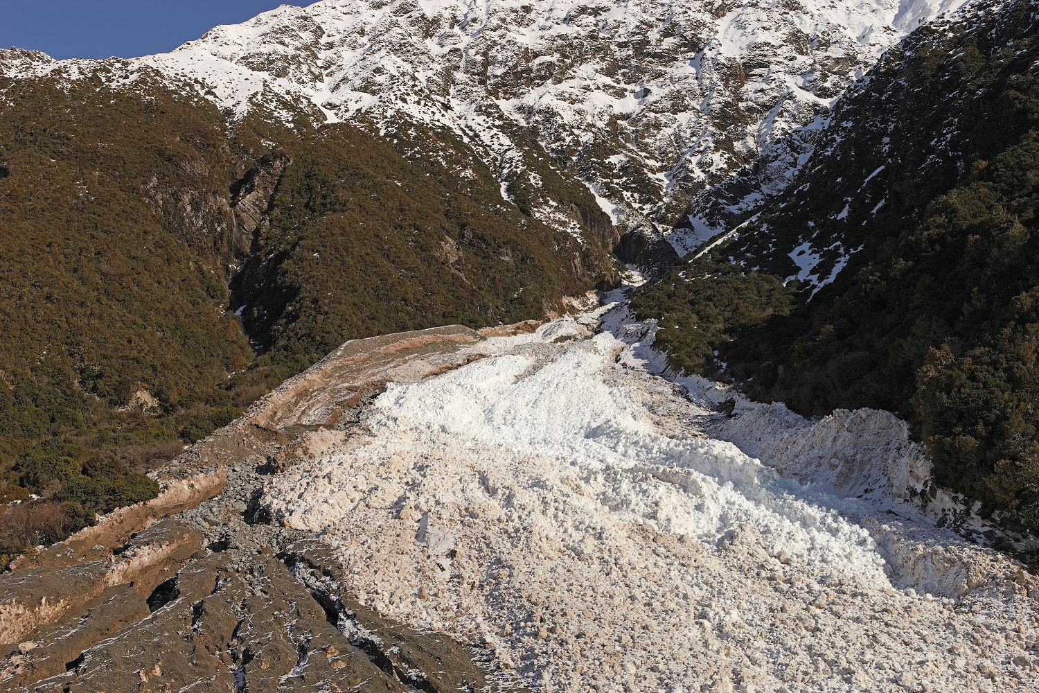
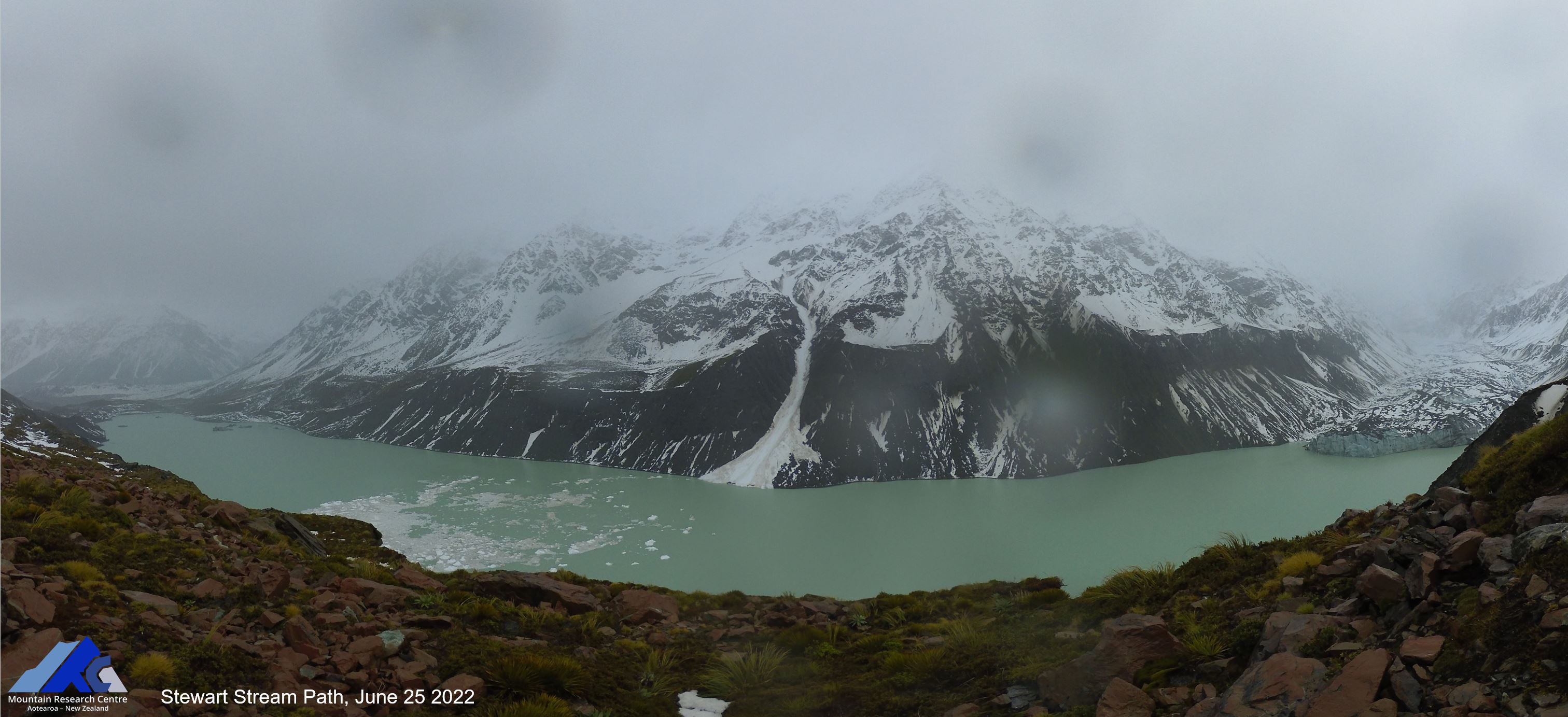
We are using a variety of sensors to document avalanche activity in the Hooker Valley, Aoraki Mount Cook National Park. The alpine valley, adjacent to the main divide of the Southern Alps/Kā Tiritiri o te Moana, regularly produces large avalanches in several key paths. Our observations are used to refine numerical models that in turn help characterize avalanche hazards in the valley. Here are some recent observations from the valley:
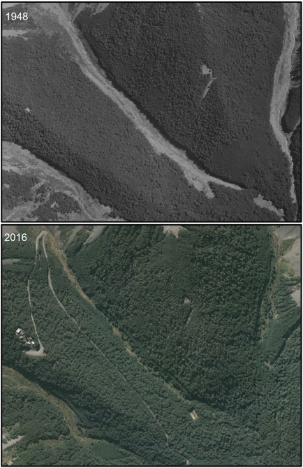
Avalanche hazards along Milford Road, Fiordland National Park
In collaboration with the Milford Road Alliance, we are using numerical modelling to better understand avalanche hazards along Milford Road in Fiordland National Park. See our paper in Natural Hazards and Earth System Sciences (Miller et al., 2022) and explore the results of our modelling work in the McPherson path in a webGIS below.

In mountains we trust.