We spent several days this summer collecting ground control points (GCPs) used to process satellite imagery and build 3D elevation models. The GCPs will be used to create accuate, high resolution (2m) surface models for a large region of Fiordland, offering a new level of detail for the iconic terrain. This fieldwork will also directly support avalanche hazard modelling in collaboration with Milford Road Alliance.
Fiordland Fieldwork
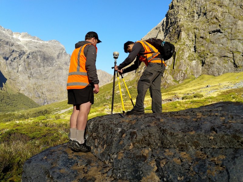
We spent several days this summer collecting ground control points (GCPs) used to process satellite imagery and build 3D elevation models. The GCPs will be used to create accuate, high resolution (2m) surface models for a large region of Fiordland, offering a new level of detail for the iconic terrain. This fieldwork will also directly support avalanche hazard modelling in collaboration with Milford Road Alliance.
In mountains we trust.