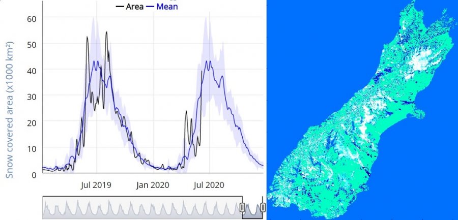
The SnOtago portal implemented a new responsive charting to bring a 20-year long time series of MODIS Terra Snow Cover Area (SCA) for interactive display. The data is updated in near real-time upon release of the latest daily MODIS MOD10A1 Snow Product. The current area covered by snow can easily be compared to the 20-year long average and daily variability.
This operational daily mapping of fractional snow cover in the South Island with MODIS produces a virtually cloud free map of snow cover area. Products from this pipeline are used to validate improvements of snow and glacier modelling in New Zealand in the context of The Deep South National Science Challenge: Snow, ice and glaciers in our changing climate, and bring better predictions about the impact of climate change on New Zealand's frozen water resources.
This release corresponds to the first large snow fall of the 2020 winter (see feature in the ODT this morning). New Zealand's snow cover was tracking well below average until this cold snap brought snow to about 30,000 km2, bringing the SCA right within average for the season. This stresses how variable seasonal snow cover is in New Zealand as recently demonstrated by our recent publication:
Find out more about our published work...
Enjoy your winter!