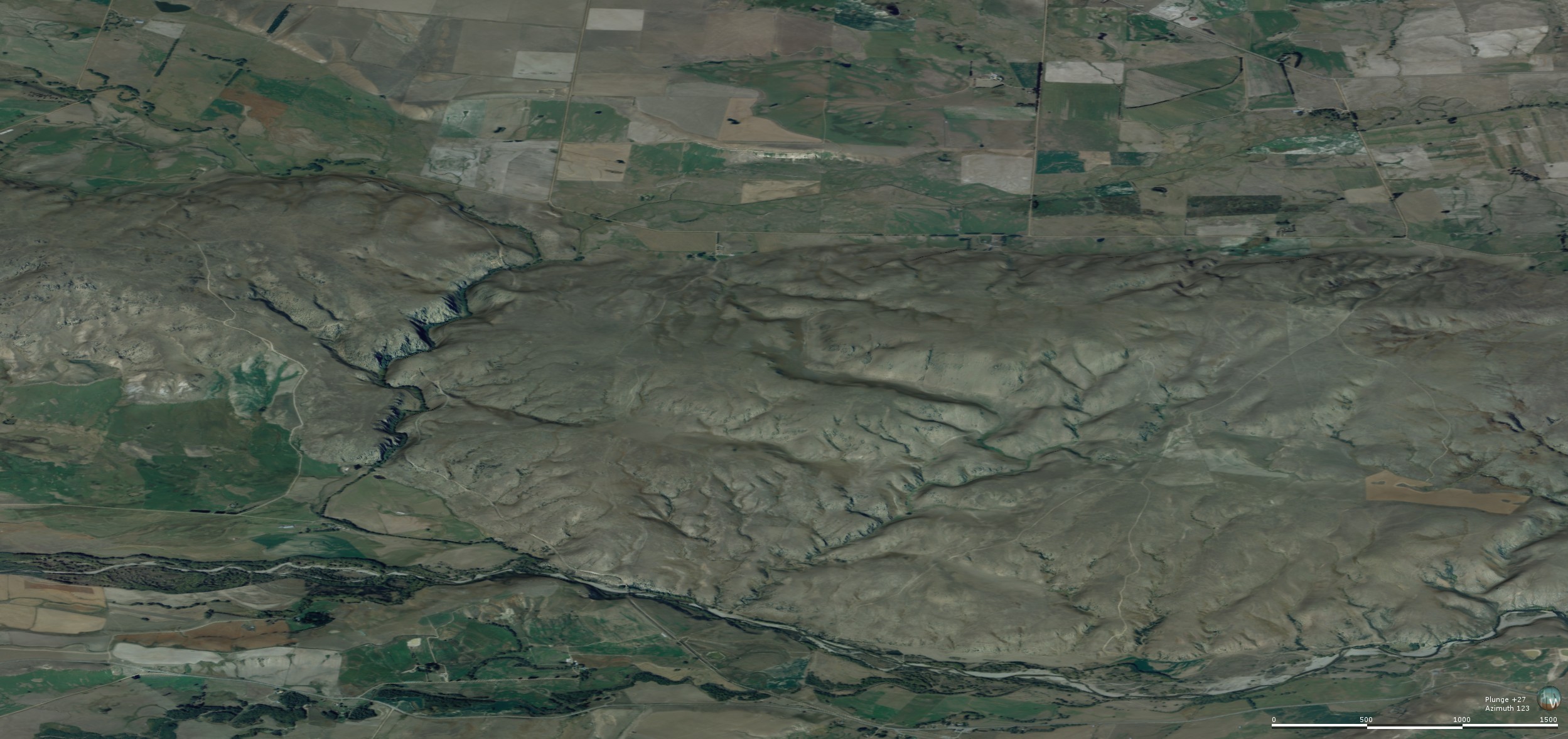
Oblique view of the Raggedy Range from the northwest, with Manuherikia River in foreground and Poolburn valley in background. The smooth gentle slopes of the range reflect the folded structure of the schist bedrock, and this fold is still developing as the range rises. The rising range has forced the Poolburn to cut a deep gorge through the range (left), through which the rail trail passes.
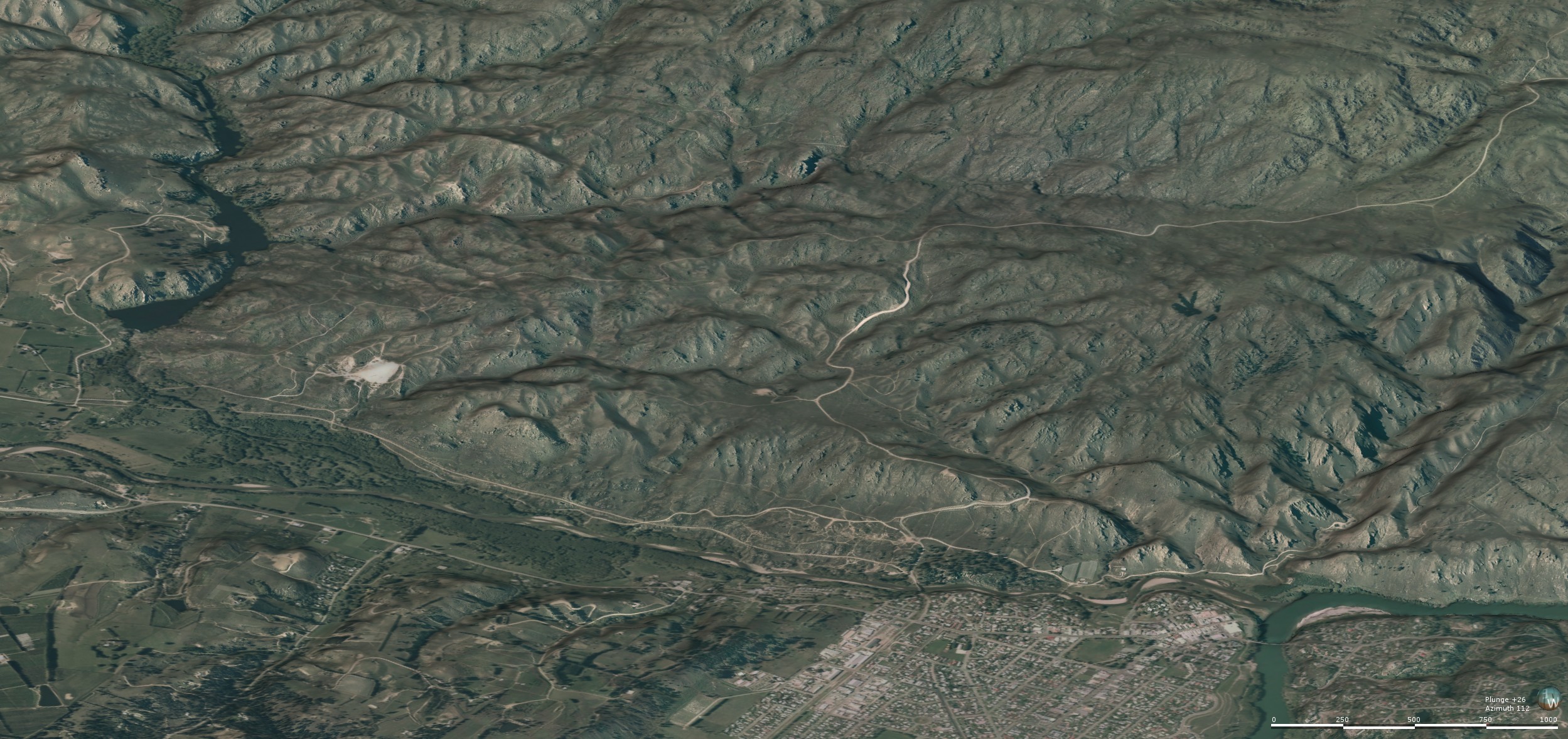
Oblique view of Tucker Hill from the northwest, with Manuherikia River, rail trail, and town of Alexandra in the foreground. The rugged topography results from uplift of schist bedrock along faults that have been active periodically for 100 million years. A white scar at centre left (near the Lower Manorburn Dam) is a remnant of 20 million year old sediments that have been uplifted and tilted along a fault zone.
Manuherikia Fault Zone: Ophir to Earnscleugh
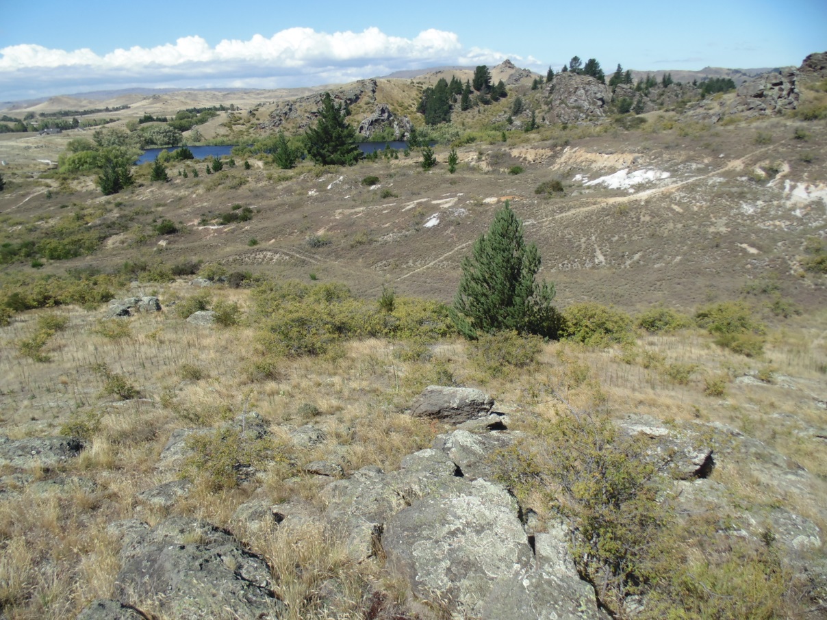
The Manuherikia River valley is a broad depression in the schist bedrock that is flanked by the Dunstan Range and the Raggedy Range. These ranges are broad up-folds (antiforms) of schist that are separated by the down-fold (synform) of the Manuherikia valley. Hence the topographic features that dominate the area have been mainly formed by the geological folding, with only minor modification by river erosion. The gentle western slopes of the Raggedy Range, in particular, reflect the wide but shallow fold structure. The fold structures have been forming slowly for the past 1 million years, and are still actively, although imperceptibly, deforming. Uplift rates are typically between 0.1 and 0.5 mm/year. The ranges have also been getting wider at similar rates, so that exposed schist bedrock extends progressively into the valley margins. The schist bedrock was covered by soft 5-20 million year old river and lake sediments over the whole area. These sediments have been eroded from the ranges, but are still preserved in the valley. The lake sediments are prominent along the rail trail between Oturehua and Chatto Creek.
The southern portion of the Raggedy Range has been made more complicated by the presence of a set of faults at the margin of the valley. The faults are geologically ancient, but some of these faults have acted as weak zones during the present folding of the region. These faults have become reactivated, leading to steeper hillsides on the valley margin between Ophir and Alexandra, and between Alexandra and Earnscleugh on the western side of the Clutha River. The most prominent feature of the faulted zone is Tucker Hill, between Galloway and Alexandra. This relatively rugged valley wall contrasts strongly with the gentle slopes of the northeastern and central portions of the Raggedy Range.
The Manuherikia River flows mostly on the southeastern side of the valley, adjacent to the Raggedy Range, for most of its length. It has been forced to remain on that side of the valley by the large gravel fans that have emanated from the Dunstan Range and partially filled the central and northwestern parts of the valley. These fans have buried the 5-20 million year old sediments over much of the Manuherikia valley.The combination of these fans, the increasing width of the Raggedy Range, and uplift along the reactivated faults along the southeastern side of the valley, has resulted in the Manuherikia River being forced to cut its way through a narrow schist gorge between Ophir and Chatto Creek.
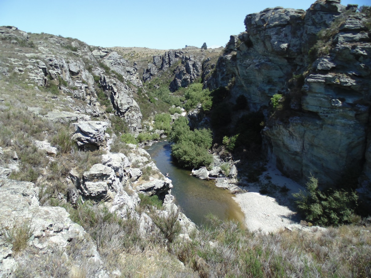
Manuherikia River gorge downstream of the historic Daniel O'Connell Bridge, Ophir. The river is cutting down into schist bedrock, as the gentle northwestern slopes of the Raggedy Range are being slowly uplifted. The rail trail climbs along the edge of the schist bedrock over Tiger Hill, to the west (right) of this gorge.
Manuherikia faults
The Manuhrikia faults were formed during uplift of the schist bedrock from the middle of the Earth's crust (about 10-15 km). This occurred about 100 million years ago, in what was mountainous topography across Otago. Those mountains have since been eroded away, leaving the generally low relief landscape that is currently being deformed. At the time of formation of these faults, the South Island was being pulled apart, and the faults formed during this regional extensional activity. Reactivation of the faults is currently occurring because of crustal-scale compressional processes associated with the Alpine Fault(*) along the western side of the Southern Alps. This has resulted in reversal of the movement along the faults, causing local steps in the topography, such as at Tucker Hill.
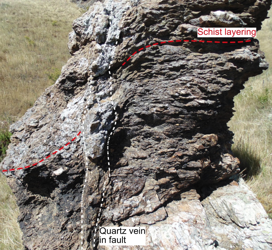
The fault zones include abundant crushed rock, some of which has been transformed to clays. Small amounts of glassy material formed where the ancient earthquake movement events were so rapid that the adjacent rocks have melted and then solidified almost instantaneously. Many of the fault surfaces are relatively soft and planar, and are easily reactivated, whereas others have been cemented with quartz, and have remained intact, as shown in the adjacent photographs. Other parts of the faults have been partially cemented by the carbonate mineral ankerite, which contains iron; weathering of that mineral causes prominent orange-brown staining on outcrops.
Fault zone at the northern end of Tucker Hill. The rock on the left is clay-rich schist, and the slopes on the right are 20 million year old sediments. The brown smooth surface in the centre is the fault plane.
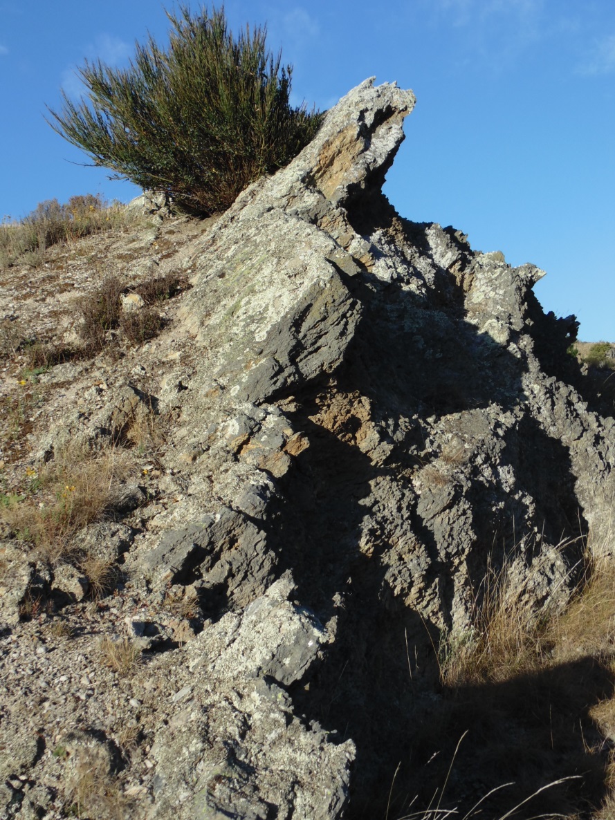
Outcrop of a fault zone at the northern end of Tucker Hill. All the outcrop consists of variably crushed schist that has been cemented with quartz to make a hard resistant rock mass.
A topographic step in schist bedrock at a reactivated fault at Lower Manorburn Dam (top left), near Galloway. The fault (red line) has cut across 20 million year old sediments (white patches) as well as schist. The fault originally (100 million years ago) moved downwards on the eastern (right distance) side, but has since been reversed and is currently moving up on the eastern side.
Gold in quartz
The quartz cement in some faults was emplaced by hot water moving through the schist bedrock from below, channelled along the crushed rock fault zone. This process also introduced gold into the fault zones, and the gold was focussed in quartz-rich rocks (quartz veins). Quartz-rich rocks with minor gold occur along the northeastern trend of many of the Manuherikia faults between Ophir and Earnscleugh. The small amount of gold in these rocks has been insufficient to be mined in the past. However, similar gold-bearing fault rocks occur along a northwesterly trend at Ophir, and these have been mined for gold historically. Both sets of gold-bearing faults formed at approximately the same time, about 100 million years ago. These gold-bearing deposits are broadly similar to those at the gold mine at Macraes (*), although the Macraes gold was emplaced at an earlier time, about 140 million years ago, before the schist bedrock was uplifted from the middle crust (10-15 km deep).
Quartz-rich fault zone with minor gold enrichment (between white dashed lines) in an outcrop of schist at Lower Manorburn Dam, near Galloway. The layering in the schist has been bent adjacent to the fault zone during fault movement 100 million years ago.The left (western) side moved downwards at that time.
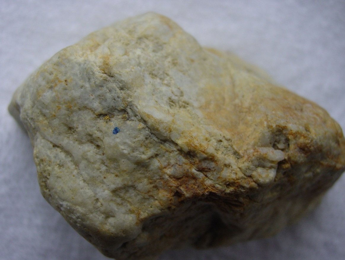
Fragment of quartz vein from a fault zone near Earnscleugh (piece is 5 cm across), with several visible gold particles (above the blue dot).
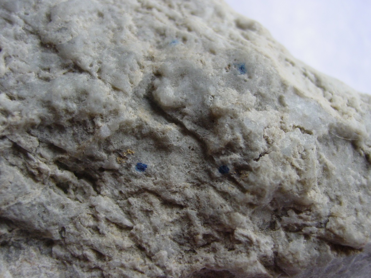
Close-up view of another fragment of quartz vein from a fault zone near Earnscleugh with several visible gold particles near the blue dots. The largest gold particle is 1 mm across.
Quartz gravels
Minor uplift and erosion of the schist bedrock occurred about 20 million years ago, and this led to development of a pile of quartz-rich river sediments resting on the schist. Some of the quartz in these sediments was derived from the immediately underlying schist, and some was derived from pre-existing quartz-rich sediments. Gold from both these sources accumulated in 20 million year old quartz gravels, especially in the zone immediately on top of the schist bedrock. The quartz vein fragments with gold, in the photographs above, were extracted from some of these quartz gravels. However, most of the gold occurs as flakes between 0.1 and 1 mm across. The gold became concentrated near the floor of ancient river channels during transport because it is extremely dense (19 times denser than water). These concentrations of gold are called placer deposits, as distinct from the quartz vein-bearing gold in the schist bedrock.
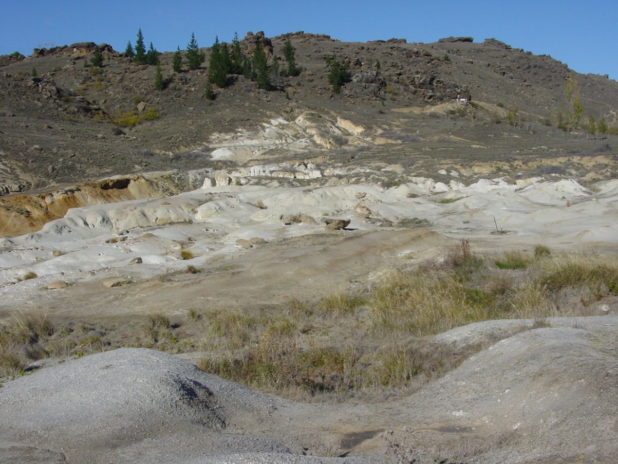
Historic placer gold workings in 20 million year old quartz gravels at Chapman Road Scientific Reserve, west of Alexandra. The white material in the background includes remnants of the sediments, and the white and grey material in the foreground and middle distance is clay-rich schist bedrock. The schist ridge in the far distance has been up-faulted against the sediments by one of the Manuherikia valley faults.
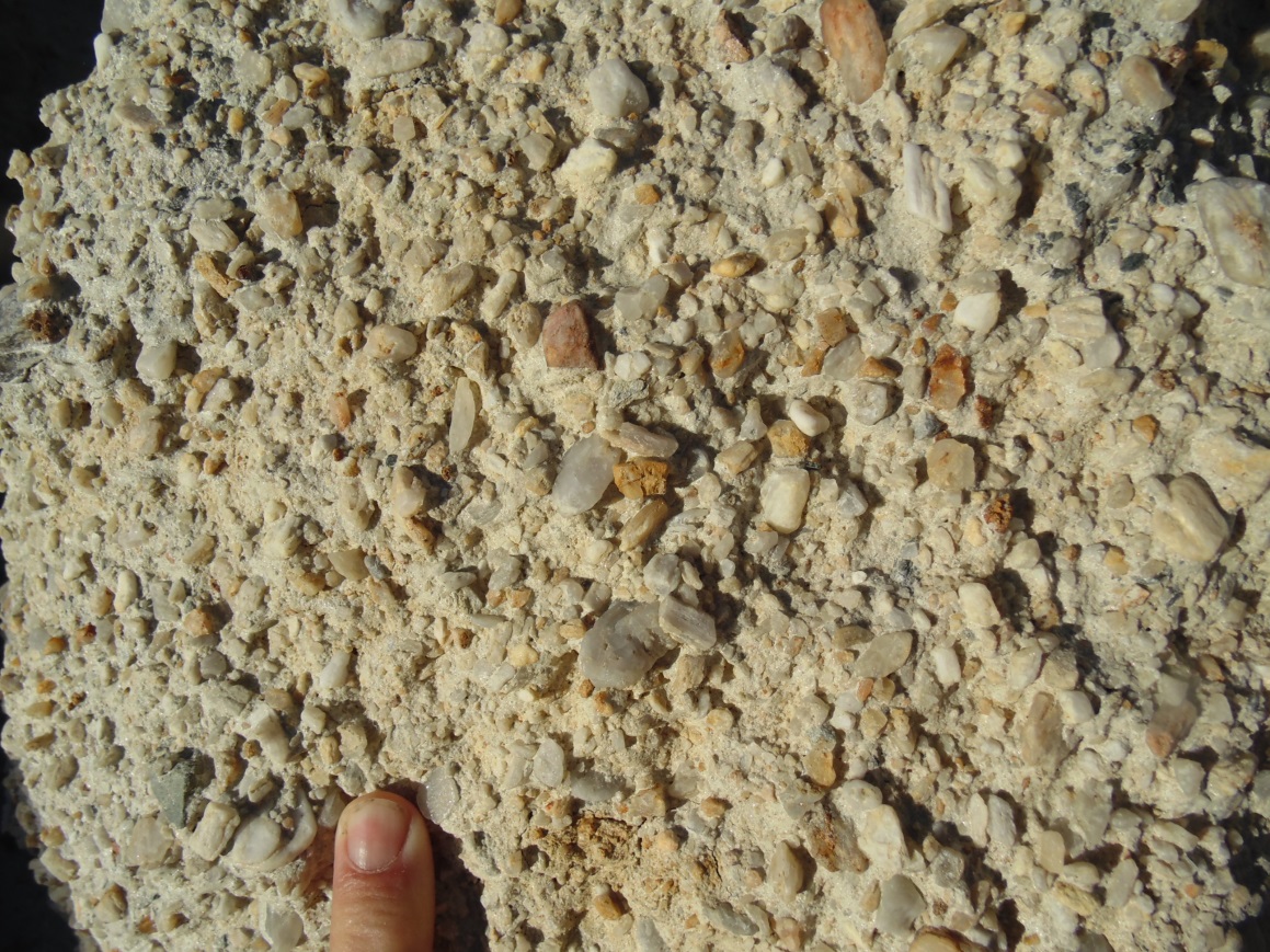
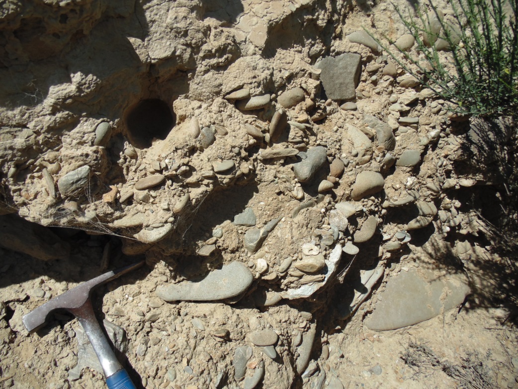
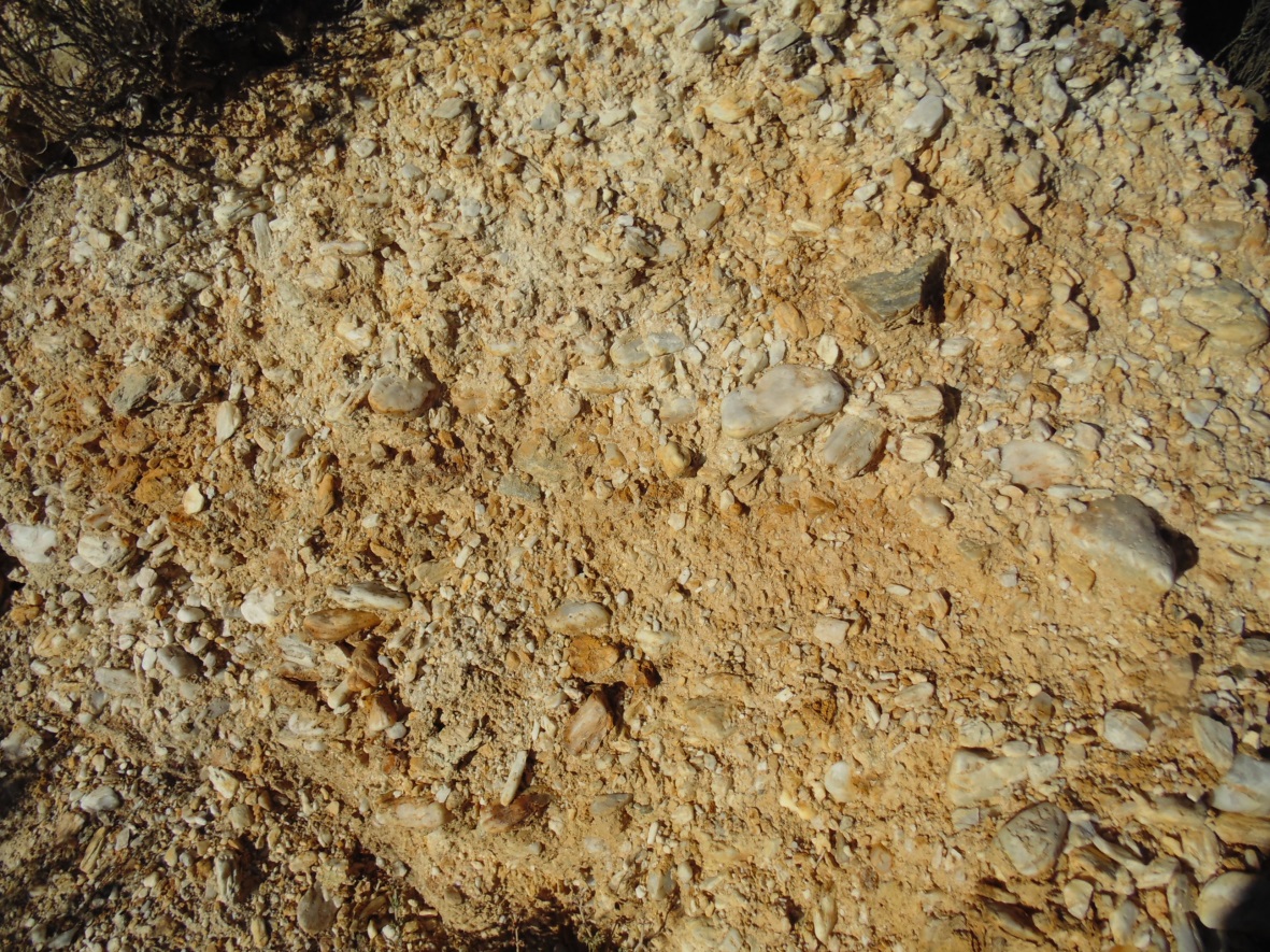
Close view of quartz pebbles (white) in old-bearing quartz gravel (20 million years old) at the north end of Tucker Hill.
Silcrete
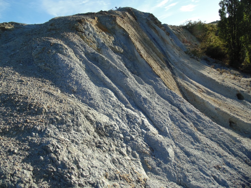
Groundwater slowly moving through the quartz gravels has dissolved some of the quartz from the surfaces of the quartz pebbles, and then deposited that quartz nearby as a cement in between the quartz pebbles. In some portions of the quartz gravels, this process has resulted in formation of very hard fully-cemented layers, called silcrete (similar to concrete, but held together with quartz rather than man-made cement). These layers can form large hard slabs on hillsides when the sediments around them have been eroded. The slabs eventually break up to form smaller boulders, that are commonly called “Sarsen stones”. Most of these silcrete boulders have smooth surfaces coated with yellow-brown rusty iron oxide. The shapes of the original quartz pebbles that formed the framework for these silcretes are commonly obscured by the quartz cement deposited over them. However, some silcretes retain their original quartz pebble texture through the subsequent erosional processes.
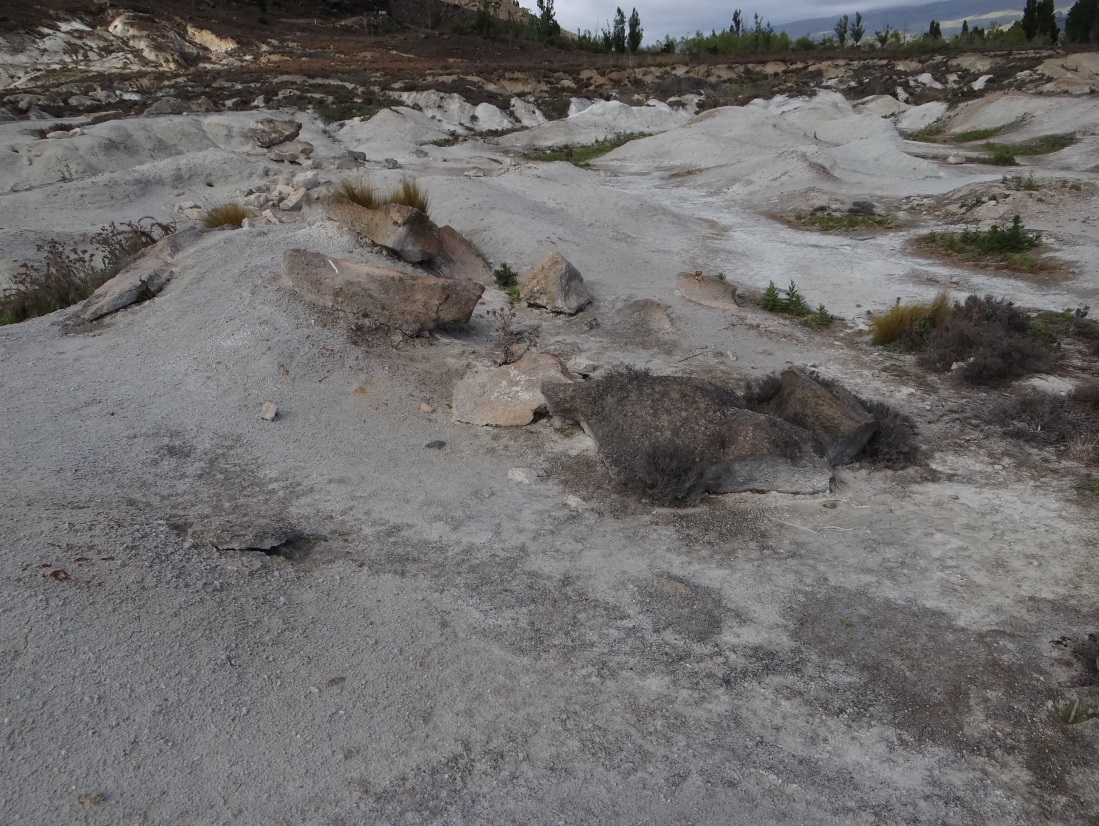
Slabs of silcrete have been left behind when miners removed gold-bearing quartz gravels at Chapman Road Scientific Reserve, west of Alexandra.
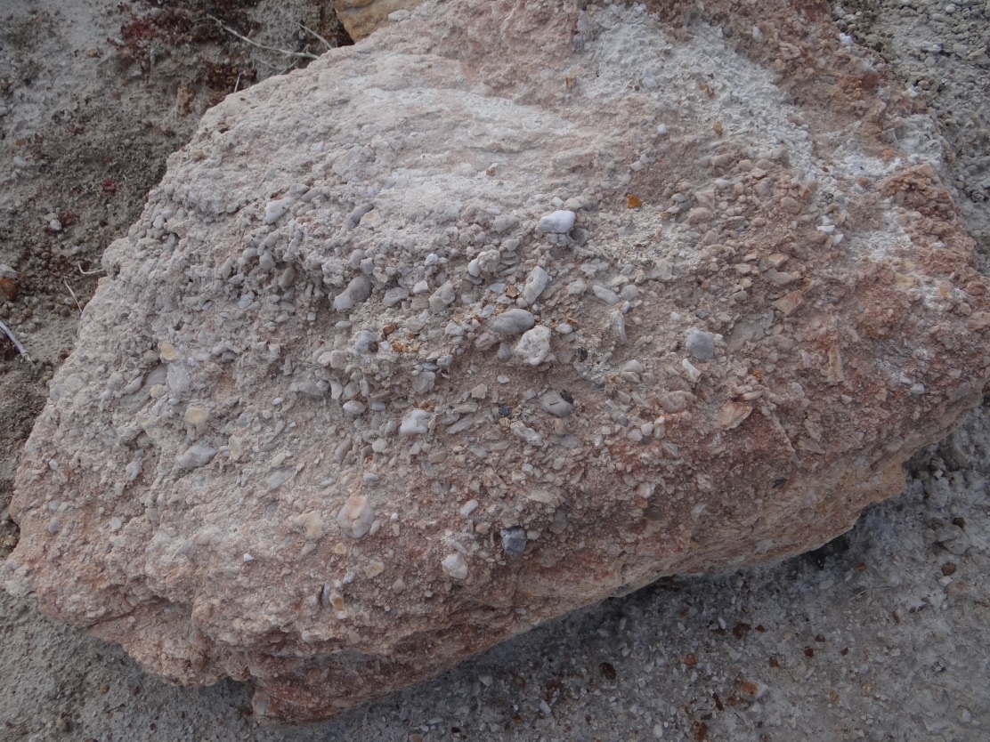
Boulder of silcrete (“Sarsen stone”, about 0.5 metre across) in which the original quartz pebble framework is still visible on the surface.
Uplift and erosion
The slow rise of the Raggedy Range over the past million years has resulted in erosion of the overlying quartz-rich sediments, and some of the underlying schist bedrock. Erosion of the bedrock formed small steep-sided gullies that characterise the lower slopes of the range. These gullies are more prominent on Tucker Hill at the southwestern end of the Raggedy Range, where the faults along the valley margin have caused steeper topography. Gravel fans have formed at the foot of these gullies, and gravels partially fill the floors of the gullies along the range margins. The gravels contain abundant schist debris, much of it slabby and angular. In addition, the gravels contain some round quartz pebbles that originated in the 20 million year old quartz gravels. Gold from the quartz veins in faults in the schist bedrock, and gold from the quartz gravels, ends up in the young gravels in the gravel fans at the base of the rising slopes. Gold is particularly concentrated at or near the base of the young gravels, often right at the underlying schist bedrock surface in channel floors. In this basal zone, large bedrock boulders (up to metre scale) have accumulated, accompanied by larger silcrete boulders from the 20 million year old sediments.
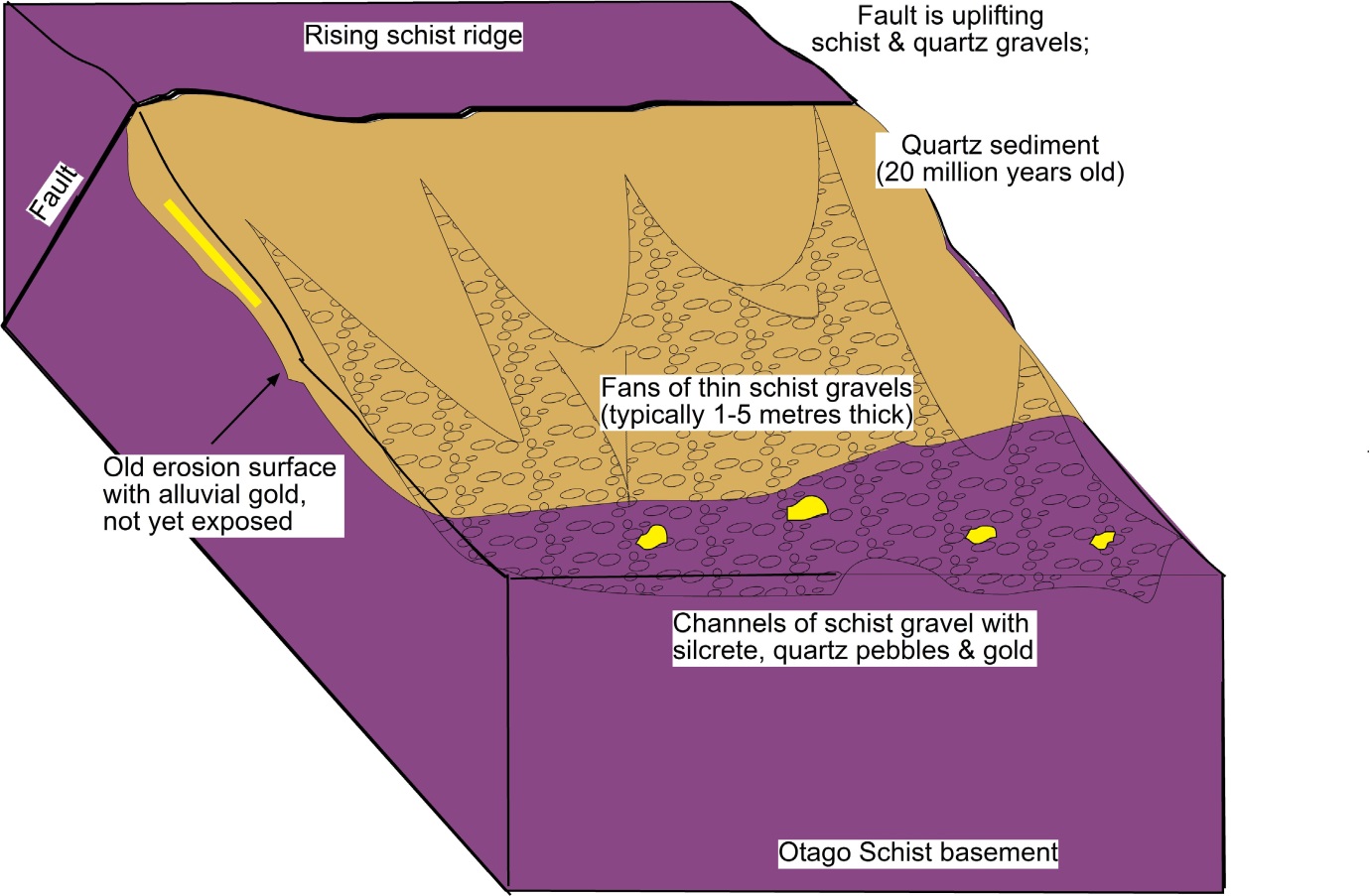
Three-dimensional sketch of a typical portion of the lower Manuherikia valley margin, showing uplift of a bedrock schist ridge along a fault, and partial erosion of 20 million year old quartz sediments and schist to form channelized gravel deposits at the base of the slope. Gold and silcrete accumulate in the young (less than 100 000 year old) gravels.
Eroded schist bedrock surface at Lower Manorburn Dam, near Galloway, with northern end of Tucker Hill on left skyline. The past occurrence of gold-bearing quartz gravels in this area is indicated by the presence of a brown silcrete boulder (upper boulder in foreground). These gravels, and most of their contained gold, have been washed into younger gravels farther down slope.
Manuherikia River gravels and gold
The Manuherikia River flows over schist bedrock for most of its course. However, the source of the river is in greywacke mountains to the northeast of St Bathans (*). Consequently, the present Manuherikia River is currently transporting abundant greywacke gravel from those source mountains. Greywacke forms hard rounded boulders, quite unlike the flaky, slabby schist. Further, most schist debris that reaches the Manuherikia River is rapidly broken up during river transport. Hence, even at Alexandra, where the Manuherikia River meets the Clutha River, the gravels in the river bed are dominated by greywacke, not schist. The schist fragments leave only pebbles of the quartz vein material that pervades most schist outcrops.
Few, if any, of the pebbles of schist quartz veins contain gold, although some rare gold-bearing quartz pebbles undoubtedly occur in places. Some gold flakes from the 20 million year old quartz gravel deposits make their way from those deposits, through the schist debris fans on the valley walls, into the main Manuherikia River channel. Hence, placer gold concentrations can build up on the bed of the Manuherikia River, and this gold was a target for historic dredging activity near Alexandra, over 100 years ago. Small accumulations of this gold build up and migrate during modern floods.
As the Manuherikia has been forced to flow along the southeastern margin of its valley, it has to continue to erode downwards as the schist ridges rise alongside it. This continuing uplift and downcutting has resulted in the river abandoning some of its older channels, with their gold-bearing, greywacke-rich, gravels. These old channels are being progressively uplifted higher above the present river level. The now-dry abandoned channels have been mined historically in numerous places between Ophir and Alexandra. The higher, older abandoned channels have also been eroded, with the schist bedrock and the 20 million year old quartz gravels, into the schist-rich gravel fans in gullies on the rising hillsides. Gold from the old Manuherikia River channels has been reconcentrated into some of these gullies as well.

Gravel in the active bed of the Manuherikia River at Alexandra. Most of the cobbles are greywacke (round, grey and brown), with some quartz pebbles derived from breakdown of schist and/or 20 million year old quartz gravels.
Old (about 100 000 years) gold-bearing Manuherikia River gravels that consist almost entirely of greywacke cobbles. These gravels occur about 30 metres above the present river bed, near Ophir.
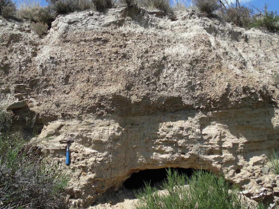
Old (about 100 000 years) greywacke-bearing Manuherikia River gravels at the base of the picture have been the target of historic surface and underground gold mining (remnant mine tunnel at centre bottom). These gravels are overlain by wind-blown silt (loess; pale yellow, in centre), and schist gravels derived from the valley margin (brown, top).
Remnant of 20 million year old quartz gravel (pebbles up to 3 cm across) on the eroding slopes of Tucker Hill, near Alexandra.
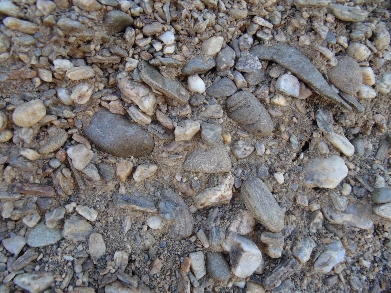
Greywacke-rich gravel (largest cobble = 10 cm long), with minor schist, and scattered rounded quartz pebbles (white), in gold workings on the slopes of Tucker Hill, near Alexandra. This gravel has been formed during downslope erosion of an uplifted Manuherikia River channel, the remnant of 20 million year old gravels in the previous photograph, and some underlying schist bedrock. Gold from all three of these sources accumulated in channel bottoms, and was the target of the historic mining.
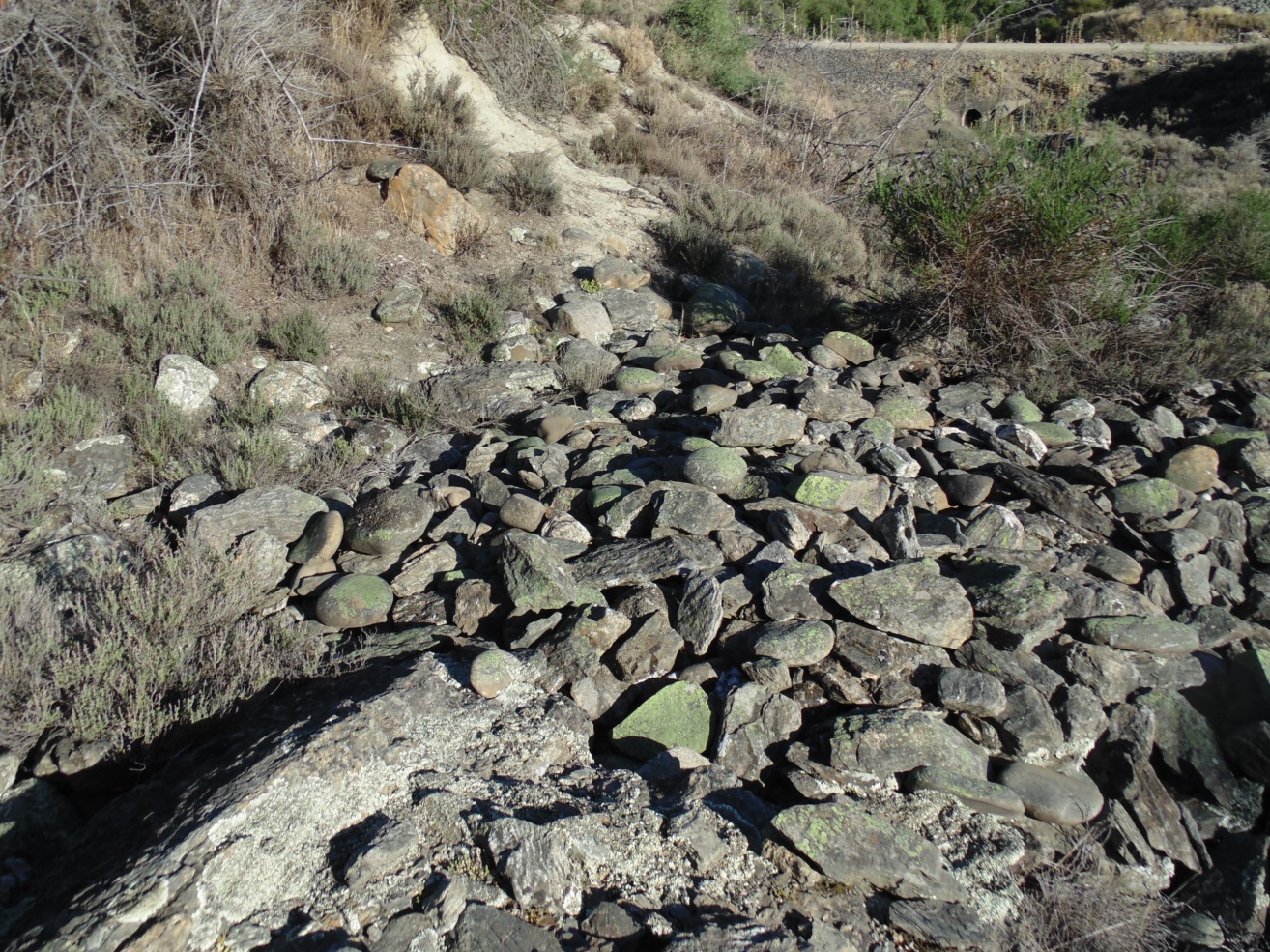
An erosional gully on the slopes of Tucker Hill, that has been exposed by historic mining. Schist bedrock in the floor of the gully (exposed in left foreground) is now covered with mined remnants of rounded boulders of greywacke from an old uplifted Manuherikia River channel. Some angular slabby schist boulders are also present, attesting to minor local bedrock erosion. A large brown silcrete boulder (left of centre in background) attests to erosion of gold-bearing 20 million year old quartz gravels on the slopes of Tucker Hill as well. Rail Trail passes in background.