Remote sensing is traditionally used to derive land cover classification. Classification of medium to very high resolution images is conducted at the School of Surveying for applications related to ecology and zoology. Methodological aspects of image processing and classification are also addressed such as multi-spectral fusion of satellite images.
Image fusion
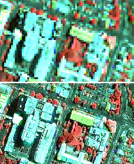 Image processing techniques known as multispectral image fusion or pan sharpening have been developed specifically to merge the rich spatial content of a high spatial resolution image (i.e., PAN band) with the rich spectral content of a low spatial resolution image (i.e., MS bands).
Today, such methods are routinely applied by some image suppliers who provide pan-sharpened multispectral images as upper level products. These images are becoming increasingly popular in various fields due to their ability to improve the detection and extraction of ground targets or the spatial resolution of post-classified products.
The School of Surveying has developed some expertise in this domain and routinely process image fusion from sensors such as Landsat ETM+ (30 to 15m), Quickbird (2.4 to 0.6m), Ikonos and Kompsat (4 to 1m) (Cullen et al., 2012). An innovative image fusion algorithm was developed to for the medium resolution MODIS sensor (500 to 250m) (Sirguey et al., 2008).
Habitat mapping
 Traditionally, unsupervised and supervised classifications of multi-spectral remotely sensed images have been conducted pixel-wise. In other words, the belonging of geographical locations to thematic classes is determined on a per-pixel basis. It is based on the similarities between pixels in terms of spectral content, each pixel being considered as an individual sample. Such approach fails to recognize the thematic meaning that can be associated with the organization of pixels in space. For example, individual pixels can be recognized as part of tree canopies, but only an expert intervention can analyse the proximity and extent of such pixels to categorize areas as forest or sparse patches.
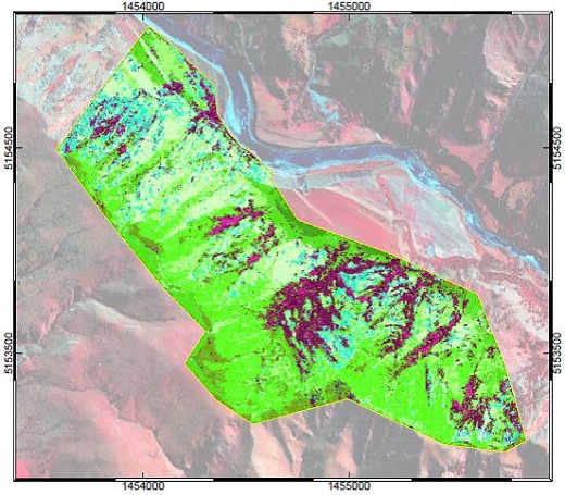 Object-based classification considers the spatial organization of pixels as part of the decision process. As collections of contiguous pixels, objects account for more information than solely spectral content. Textural information such as homogeneity, similarity, contrast, as well as morphological information such as compactness can become used and improve the classification process.
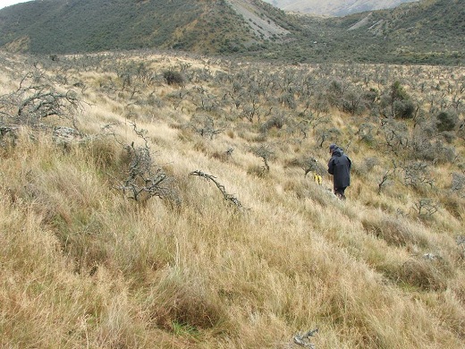
This approach is used at the School of Surveying to produce land cover/habitat classifications from satellite imagery and support behavioural studies from animal such as farmed deer monitored with GPS collars, as well as ferral cats or Hedgehogs (Recio et al. 2011).
Collaborations
- AgResearch (www.agresearch.co.nz)
Selected publications and outcomes
Sirguey, P.; Mathieu, R.; Arnaud, Y.; Khan, M. M. & Chanussot, J. (2008), 'Improving MODIS spatial resolution for snow mapping using wavelet fusion and ARSIS concept', IEEE Geoscience and Remote Sensing Letters 5(1), 78-82.