BSurv (Otago), MSc Hydrography (Plymouth) FIG/IHO/ICA Category A
Email emily.tidey@otago.ac.nz
Tel +64 3 479 7587
Room Surveying building, 1st floor, room 112
Profile
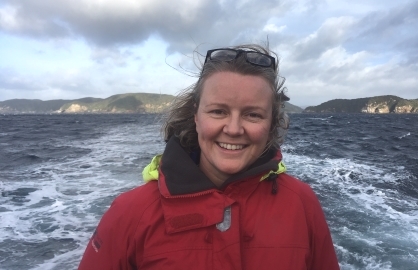
At Te Kura Kairūri I manage Hydrographic Surveying – teaching students and working with researchers from Surveying, Marine Science and Geology, as well as running demonstrations with visiting school students. I am a past student of the School of Surveying, and joined the staff in 2013.
I have been part of several research cruises on the university research vessel Polaris II and am on the management team for our new multibeam echo sounder. I teach practical hydrography skills around Dunedin Harbour and along the Otago Coast on the university research vessels Polaris II, Beryl Brewin and Tūhura.
Prior to coming to Otago I completed my MSc (Hydrography) on the FIG/IHO/ICA recognised Category A course in Plymouth, UK. My background also includes several years working worldwide on a variety of hydrographic projects including charting, habitat mapping, oil and gas, renewables and offshore construction.
I thoroughly enjoy being at sea and like to learn, share and apply all aspects of nautical knowledge to my teaching.
Teaching
- SURV 201 Surveying Methods 1 (coordinator)
- SURV 322 Hydrographic Surveying (coordinator)
- SURV 452/552 Hydrographic Surveying 2 (coordinator)
- SURV 470 Professional Project (supervisor - hydrographic projects)
- OCEN 301 Practical and Field Oceanography (lecturer and demonstrator)
- SURV 298 Introductory Field Camp (demonstrator)
- SURV 399 Third Year Field Course (demonstrator)
Research interests
- Underwater acoustics, sound velocity measurement and application
- Use of multibeam sonar in shallow coastal waters and deep offshore canyons
- Using hydrographic data for more than one purpose - charting, geophysical analysis, habitat mapping, sea-level analysis
- Hydrographic surveying in rivers and lakes
- Hydrographic surveying education and development in NZ / Australasia
Research themes
Emily is also a member of the Coastal People: Southern Skies collaboration that connects communities with world-leading, cross-discipline research to rebuild coastal ecosystems.
Coastal People: Southern Skies
Projects
Current projects
- PhD: Hydrographic measurements as spatial predictors of marine habitats and processes
- Low-cost RTK GNSS for hydrography
Completed projects
- Tuia-250 investigations: Commemorating 250 years since the first encounters between Māori and Captain Cook’s European crew in 1769. Publications in 2019: New Zealand Surveyor.
- Auckland Islands seafloor mapping investigations, bathymetry and glacial geomorphology. Publications in 2018-2019: Quaternary Research, Geosciences and Antarctic Science.
- Art+Ocean exhibitions. Publications in 2018: Exhibition Catalogue and Junctures.
- Hydrographic mapping of Tasman Glacier terminal lake. Publication in 2016: Global & Planetary Change.
- MSc thesis: Optimal use of Underway SV Measurements in a Multibeam Survey on the Tamar Estuary, 2012
- BSurv honours dissertation: Hydrographic Surveying in Marine Protected Areas, 2006
Current student projects
- Hannah Mello: The Effect of Marine Protection on New Zealand Bryozoa (PhD). Co-supervision with Abby Smith (Marine Science), Anna Wood (Ecology) and Dennis Gordon (NIWA, Wellington).
- Maddy Glover: Current and historical extent of Macrocystis pyrifera forests in the South-eastern South Island (MSc). Co-supervision with Chris Hepburn (Marine Science), Matt Desmond (Marine Science) and Anne-Marie Jackson (Physical Education, Sport & Exercise Sciences).
Completed student projects
- Robbie Columbus: Low-cost, single frequency, relative positioning of GNSS tide buoys and their use within a densified tide monitoring network, SURV470 project, 2019
- Kara Jurgens: A Comparison of Different Multibeam Frequencies and Sonar Settings; The Marine Maid Shipwreck, Stewart Island, SURV470 project, 2019
- Jean Louis Morrison: Surveying and Marine Science: Using Bathymetric Data to Complement Marine Science Investigations in Port Pegasus, Stewart Island, SURV470 project, 2019
- Rian Mayhead: Unmanned Surface Vehicles. Toys or Tools? SURV470 project, 2018
- Matt Barber: Mapping Where Yellow-Eyed Penguins are Foraging, Using Modern Hydrographic Acoustic Techniques, SURV470 project, 2017
- Sam McLoy: The Role of a Surveyor in Hydrographic Research, SURV470 project, 2016
- Thomas Rutter: An Investigation into the Use of Remotely Operated Survey Vessels (ROSV) for a Multibeam, Nautical Charting Survey, SURV470 project, 2015
- Ian Hauman: The Use of Oblique Angled Single Beam Echo Sounding for Detecting Bridge Scouring, SURV470 project, 2014
Responsibilities
University
- Near Geophysical Imaging Research Facility (NGIF) Management Team Leader (2016 – present)
School of Surveying
- School of Surveying Research Seminar coordinator (2019 - present)
- School of Surveying Undergraduate Committee (2013 – present)
- School of Surveying Marketing Committee (2013 – present)
Professional Activities
Awards and achievements
- 2017 Best Poster, New Zealand Coastal Society Conference
- 2014 FIG Foundation Young Surveyor Fellow Award
- 2011 Education Award, Australasian Hydrographic Society (AHS)
Other positions and professional responsibilities
- Current member of S+SNZ Hydrography Professional Stream (HPS) leadership team
- Current chair of the Australasian Hydrographic Society (AHS) Education Award
- Current member of NZ Region (NZR) AHS Executive Team
- 2017-2019: Member of Survey and Spatial NZ (S+SNZ) Council and Chair of S+SNZ HPS
Memberships
- Member of the Australasian Hydrographic Society (AHS), 2011 – present
http://www.ahs.asn.au
- Member of Survey and Spatial New Zealand (S+SNZ), previously New Zealand Institute of Surveyors (NZIS), 2017 – present (Professional Associate 2007-2017)
http://www.surveyspatialnz.org
- Member of NZ Marine Geospatial Working Group (NZMG-WG), 2019 - present
- Member of the Association for Women in the Sciences (AWIS), 2019 - present
https://www.awis.org.nz/

Publications
Perkins, E. J., Gorman, A. R., Tidey, E. J., Wilson, G. S., Ohneiser, C., Moy, C. M., Riesselman, C. R., Gilmer, G., & Ross, B. S. (2020). High-resolution seismic imaging reveals infill history of a submerged Quaternary fjord system in the subantarctic Auckland Islands, New Zealand. Quaternary Research, 93(1), 255-266. doi: 10.1017/qua.2019.58
Tidey, E. J., & Hulbe, C. (2019). Sub-Antarctic Auckland Islands seafloor mapping investigations using legacy data. Geosciences, 9(2), 56. doi: 10.3390/geosciences9020056
Tidey, E. J., & Hulbe, C. L. (2018). Bathymetry and glacial geomorphology in the sub-Antarctic Auckland Islands. Antarctic Science, 30(6), 357-370. doi: 10.1017/S0954102018000342
Purdie, H., Bealing, P., Tidey, E., Gomez, C., & Harrison, J. (2016). Bathymetric evolution of Tasman Glacier terminal lake, New Zealand, as determined by remote surveying techniques. Global & Planetary Change, 147, 1-11. doi: 10.1016/j.gloplacha.2016.10.010
Morrison, J.-L., Tidey, E., Schenck, R., & Wilson, G. (2019). Surveying and Marine Science: Using bathymetric data to complement marine science investigations in Port Pegasus, Stewart Island. Proceedings of the New Zealand Coastal Society (NZCS) Annual Conference. (pp. 114). Retrieved from https://www.coastalsociety.org.nz/
Perkins, E. J., Gorman, A. R., Tidey, E. J., Wilson, G. S., Ohneiser, C., Moy, C. M., Riesselman, C. R., Gilmer, G., & Ross, B. S. (2020). High-resolution seismic imaging reveals infill history of a submerged Quaternary fjord system in the subantarctic Auckland Islands, New Zealand. Quaternary Research, 93(1), 255-266. doi: 10.1017/qua.2019.58
Journal - Research Article
Tidey, E. J., & Hulbe, C. (2019). Sub-Antarctic Auckland Islands seafloor mapping investigations using legacy data. Geosciences, 9(2), 56. doi: 10.3390/geosciences9020056
Journal - Research Article
Tidey, E. J., & Hulbe, C. L. (2018). Bathymetry and glacial geomorphology in the sub-Antarctic Auckland Islands. Antarctic Science, 30(6), 357-370. doi: 10.1017/S0954102018000342
Journal - Research Article
Purdie, H., Bealing, P., Tidey, E., Gomez, C., & Harrison, J. (2016). Bathymetric evolution of Tasman Glacier terminal lake, New Zealand, as determined by remote surveying techniques. Global & Planetary Change, 147, 1-11. doi: 10.1016/j.gloplacha.2016.10.010
Journal - Research Article
Morrison, J.-L., Tidey, E., Schenck, R., & Wilson, G. (2019). Surveying and Marine Science: Using bathymetric data to complement marine science investigations in Port Pegasus, Stewart Island. Proceedings of the New Zealand Coastal Society (NZCS) Annual Conference. (pp. 114). Retrieved from https://www.coastalsociety.org.nz/
Conference Contribution - Published proceedings: Abstract
Glover, M., Hepburn, C., Desmond, M., Tidey, E., & Jackson, A.-M. (2019). Habitat mapping of Macrocystis pyrifera (M. pyrifera) along nearshore coastal Southern Otago, New Zealand. Proceedings of the New Zealand Coastal Society (NZCS) Annual Conference. (pp. 70). Retrieved from https://www.coastalsociety.org.nz/
Conference Contribution - Published proceedings: Abstract
Tidey, E., Columbus, R., Jurgens, K., Mayhead, R., Morrison, J.-L., & Odolinski, R. (2019). Student hydrographers professional coastal science projects at the School of Surveying, University of Otago. Proceedings of the New Zealand Coastal Society (NZCS) Annual Conference. (pp. 118). Retrieved from https://www.coastalsociety.org.nz/
Conference Contribution - Published proceedings: Abstract
Tidey, E., Jurgens, K., & Morrison, J.-L. (2019). Tuia: 250 years of navigation, map making and belonging. Proceedings of the New Zealand Coastal Society (NZCS) Annual Conference. (pp. 76). Retrieved from https://www.coastalsociety.org.nz/
Conference Contribution - Published proceedings: Abstract
Tidey, E., Goulstone, N. J. S., & Odolinski, R. (2018, October-November). Low-cost RTK GNSS for hydrography. Verbal presentation at the HYDRO18 Conference: The Climate for Change: Hydrography in the 21st Century, Sydney, Australia.
Conference Contribution - Verbal presentation and other Conference outputs
Tidey, E. J., & Desmond, M. J. (2018, May). Towards habitat mapping multibeam data collection protocols: A case study from coastal Otago, New Zealand. Verbal presentation at the 17th Annual Marine Geological & Biological Habitat Mapping (GeoHab) Conference, Santa Barbara, USA.
Conference Contribution - Verbal presentation and other Conference outputs
Jones, J., Logez, A., Mayhead, R., & Tidey, E. (2018). 'Hydro day' at the 2018 NZIS Conference in Nelson. Surveying+Spatial, (95), 21-26.
Journal - Professional & Other Non-Research Articles
Coutts, B., Shiu, W., & Tidey, E. (2018). A case for commision 1. Proceedings of the International Federation of Surveyors (FIG) Congress: Embracing Our Smart World Where the Continents Connect: Enhancing the Geospatial Maturity of Societies. 9594. Retrieved from http://www.fig.net/fig2018/
Conference Contribution - Published proceedings: Full paper
Tidey, E., & Webster, T. (2018). Characteristics of benthic foraging habitat for hoiho. Proceedings of the Birds New Zealand Conference. (pp. 14-15). Retrieved from https://www.osnz.org.nz/
Conference Contribution - Published proceedings: Abstract
Tidey, E., & Cameron, B. (2018). How can I see what I can’t see? [Conversation]. Junctures, (19), 52-58.
Journal - Research Other
Tidey, E. (2018, May). Hydro 101: I need to undertake a hydrographic survey, what do I do? Verbal presentation at the New Zealand Institute of Surveyors (NZIS) 129th Conference, Nelson, New Zealand.
Conference Contribution - Verbal presentation and other Conference outputs
Tidey, E., & Logez, A. (2018, May). Hydro research at Otago University. Verbal presentation at the New Zealand Institute of Surveyors (NZIS) 129th Conference, Nelson, New Zealand.
Conference Contribution - Verbal presentation and other Conference outputs
Desmond, M. J., Hepburn, C. D., Scott, N. J., & Tidey, E. J. (2018, May). Reclaiming the knowledge of fisheries habitat distribution within a customary management framework. Verbal presentation at the 17th Annual Marine Geological & Biological Habitat Mapping (GeoHab) Conference, Santa Barbara, USA.
Conference Contribution - Verbal presentation and other Conference outputs
Tidey, E. J., & Hulbe, C. L. (2018). Subsea geomorphology in the sub-Antarctic Auckland Islands. Proceedings of the New Zealand Geographical Society (NZGS) and the Institute of Australian Geographers (IAG) Conference. (pp. 135-136). Retrieved from https://nzgsconference2018.org/
Conference Contribution - Published proceedings: Abstract
Tidey, E. & Brain, E. (2018). Exhibition catalogue essay Maps help us understand our environment: Who knows what’s down there? Art + Oceans Exhibition, H D Skinner Annex, Otago Museum, Dunedin, New Zealand. [Exhibition Catalogue].
Other Research Output
Tidey, E. & Cameron, B. (2018). Exhibition catalogue essay Maps help us understand our environment: How can I see what I can’t see? Art + Oceans Exhibition, H D Skinner Annex, Otago Museum, Dunedin, New Zealand. [Exhibition Catalogue].
Other Research Output
Tidey, E. (2018, April). Hydrographic measurements as spatial predictors of marine habitats and processes. School of Surveying, University of Otago, Dunedin, New Zealand. [Department Seminar].
Other Research Output
Tidey, E. (2018, September). Hydrography + Marine Science. Marine Science Seminar Series, Department of Marine Science, University of Otago, Dunedin, New Zealand. [Department Seminar].
Other Research Output
Tidey, E. J. (2018, October-November). University education for hydrographers. Verbal presentation at the HYDRO18 Conference: The Climate for Change: Hydrography in the 21st Century, Sydney, Australia.
Conference Contribution - Verbal presentation and other Conference outputs
Tidey, E. (2018). Who knows what’s down there? Junctures, (19), 59-63.
Journal - Research Article
Evans, R., Fraser, M., Josephs, S., Nicholls, R., & Tidey, E. (2017). A review of the Australasian Hydrographic Society (NZR AHS) seminar. Surveying+Spatial, (91), 11-15.
Journal - Professional & Other Non-Research Articles
Tidey, E. (2017). Collect once, use many times: Bathymetric data shows us the past and present submarine environments of the Auckland Islands. Proceedings of the New Zealand Institute of Surveyors (NZIS) 128th Conference: Frameworks for the Future. Retrieved from http://www.nzisconference.org.nz/
Conference Contribution - Published proceedings: Abstract
Tidey, E. J., & Hulbe, C. L. (2017). Submarine geomorphology in the sub-Antarctic Auckland Islands. In J. Baker & M. Rowe (Eds.), Geoscience Society of New Zealand Miscellaneous Publication. 134A, (pp. 114-115). Takaka, New Zealand: GSNZ. [Abstract]
Conference Contribution - Published proceedings: Abstract
Tidey, E. (2017, July). Working across the seas. International Initiatives: A seminar series showcasing all things International at Otago, International Office, University of Otago, Dunedin, New Zealand. [Department Seminar].
Other Research Output
Tidey, E. J. (2017, March). Who's in charge? Hydrographic surveyor education and certification. Verbal presentation at the Surveying and Spatial Sciences Institute (SSSI) and New Zealand Institute of Surveyors (NZIS) Seminar, Wellington, New Zealand.
Conference Contribution - Verbal presentation and other Conference outputs
Tidey, E. J., Barber, M. J., & Webster, T. A. (2017). Yellow-eyed penguin habitat mapping trial. Proceedings of the New Zealand Coastal Society (NZCS) 25th Annual Conference. (pp. 123). NZCS. Retrieved from http://www.coastalsociety.org.nz/
Conference Contribution - Published proceedings: Abstract
Purdie, H., Tidey, E., Bealing, P., Harrison, J., & Gomez, C. (2016, February). Evolution and morphology of a lake calving glacier terminus. Verbal presentation at the New Zealand Geographical Society Conference: Geographical Interactions, Dunedin, New Zealand.
Conference Contribution - Verbal presentation and other Conference outputs
Purdie, H., Bealing, P., Tidey, E., & Harrison, J. (2016). Subaqueous terminus evolution at Tasman Glacier, New Zealand, as determined by remote-controlled survey. Geophysical Research Abstracts, 18, EGU2016-5174. [Abstract]
Conference Contribution - Published proceedings: Abstract
Tidey, E., & Hulbe, C. L. (2016, February). Submarine environments of the Auckland Islands. Verbal presentation at the New Zealand Geographical Society Conference: Geographical Interactions, Dunedin, New Zealand.
Conference Contribution - Verbal presentation and other Conference outputs
Purdie, H., Bealing, P., Tidey, E., & Gomez, C. (2015). Bathymetric and terminus evolution as determined by remote-sensing techniques: Tasman Glacier, New Zealand. Proceedings of the Snow and Ice Research Group (SIRG) Annual Meeting. (pp. 15). SIRG. Retrieved from http://sirg.org.nz/
Conference Contribution - Published proceedings: Abstract
Robbie, S., Bathgate, M., Connell, E., He, K., & Tidey, E. (2015). Our seas and oceans still to be explored and charted. Surveying+Spatial, (83), 30-33.
Journal - Professional & Other Non-Research Articles
Purdie, H., Bealing, P., Tidey, E., & Gomez, C. (2015, June). Use of a remote-controlled jet boat to survey bathymetry at the terminus of a lake-calving glacier: Tasman Glacier, New Zealand. Verbal presentation at the New Zealand Region of the Australasian Hydrographic Society (AHS)Annual Seminar: Our Seas and Oceans: Still to be Explored and Charted, Wellington, New Zealand.
Conference Contribution - Verbal presentation and other Conference outputs
Tidey, E. (2015, June). What are the graduates up to? Verbal presentation at the New Zealand Region of the Australasian Hydrographic Society Annual Seminar: Our Seas and Oceans: Still to be Explored and Charted, Wellington, New Zealand.
Conference Contribution - Verbal presentation and other Conference outputs
Tidey, E. (2014). A young hydrographic surveyor's vision for the future of the profession. Surveying+Spatial, 80, 49-50. [Commentary].
Journal - Professional & Other Non-Research Articles
Tidey, E. (2014, October-November). Hydrographic surveying at the University of Otago. Verbal presentation at the New Zealand Institute of Surveyors Conference, New Plymouth, New Zealand.
Conference Contribution - Verbal presentation and other Conference outputs
Tidey, E., & Leonard, G. (2014). Surveying in the Sub-Antarctic. Surveying+Spatial, 80, 5-9.
Journal - Professional & Other Non-Research Articles
Tidey, E. (2014, May). Marine habitat mapping. Department of Marine Science Seminar Series, University of Otago, Dunedin, New Zealand. [Department Seminar].
Other Research Output
Tidey, E. (2013, August). Hydrography: The big picture and the finer detail. School of Surveying Seminar, University of Otago, Dunedin, New Zealand. [Department Seminar].
Other Research Output
Tidey, E. (2013). Surveying at sea. In M. Strack (Ed.), Survey marks. (pp. 145-152). Dunedin, New Zealand: School of Surveying, University of Otago & the New Zealand Institute of Surveyors.
Chapter in Book - Research
Todd, E. (2012). Use of underway SV measurements in a multibeam survey on the Tamar Estuary (MSc). Plymouth University, UK. Retrieved from http://hdl.handle.net/10026.2/1767
Awarded Masters Degree
Todd, E. (2011). Inshore bathymetric surveying in Australia. Survey Quarterly, 65, 25-28.
Journal - Professional & Other Non-Research Articles