
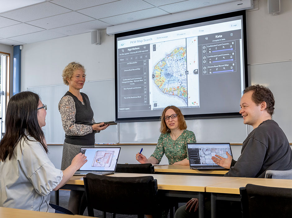
Dr Claudia Ott (standing) with her team, from left, Dr Veronica Liesaputra, Dr Caitlin Owen and Laurie Lloyd-Jones. The group has partnered with Parininihi ki Waitōtara in Taranaki to transform historic records and maps into a digital tool – the PKW Map Web Interface. PHOTO: Graham Warman
An Otago partnership in Taranaki is transforming historic records and maps into a powerful new tool – helping reconnect whānau with their ancestral whenua.
For Adrian Poa, the long hours and days he would spend combing through decades-old documents and land records presented more than just an archival headache.
It spoke to a deeper struggle of reconnecting whānau with their whenua and whakapapa, in a region where historic land confiscations have left a legacy of profound loss and trauma.
In his day-to-day role at Parininihi ki Waitōtara (PKW) – Taranaki’s largest Māori landowner – Adrian works with shareholders descended from owners affected by the Crown’s confiscation of vast areas of land in the 1860s.
While some of this land was later returned, it was not given back to the original owners, and later government policies further complicated ownership.
In the wake of the 1963 Crown-mandated amalgamation, which consolidated hundreds of individual blocks into a single reserve, Taranaki Māori landowners formed the PKW Incorporation in 1976 to protect their whenua.
Today, it is a thriving operation with interests across multiple industries, run for the benefit of present and future generations of shareholders.
Still, as the amalgamations dissolved traditional, parcel-based whakapapa links, many whānau have been left detached from land that once belonged to their tipuna.
Part of PKW’s mission is to help trace them.
While personally fulfilling and rewarding, this has proven a painstaking process for Adrian, who has long had to turn to volumes of old records, court minutes and historic maps to find information sought by whānau.
“It could sometimes take hours – and even days,” says Adrian, who serves as the incorporation’s Te Rau Tātai/Shareholder Engagement Advisor.
“In some cases, I’d find the names of land blocks had changed over time, and we couldn’t locate where they were. Other times, we’d find even the names of people in our files had changed.”
The need for a better system to reconnect people and land was obvious.
It became the goal of a years-long collaborative project – Te Tātari Raraunga – between PKW, the University of Auckland and Victoria University of Wellington.
Using machine learning and specialised algorithms, it drew upon a vast trove of historic records to create a sophisticated electronic tool.
At the project’s completion in 2022, another need arose. That is where the University of Otago stepped in.
Toitū Te Whenua – Land Information New Zealand (LINZ) had made available more than 320 historical roll plans, or surveys, of the Taranaki district as high-resolution digital scans.
One of Te Tātari Raraunga’s lead investigators, Professor Stephen MacDonell, put Adrian and Puna Wano-Bryant, PKW’s Te Rautitikura/General Manager of Shareholder Engagement, in touch with Otago's Drs Claudia Ott and Veronica Liesaputra (Computer Science).
Soon after, the researchers travelled to Taranaki with Otago colleagues Dr Caitlin Owen and Laurie Lloyd-Jones.
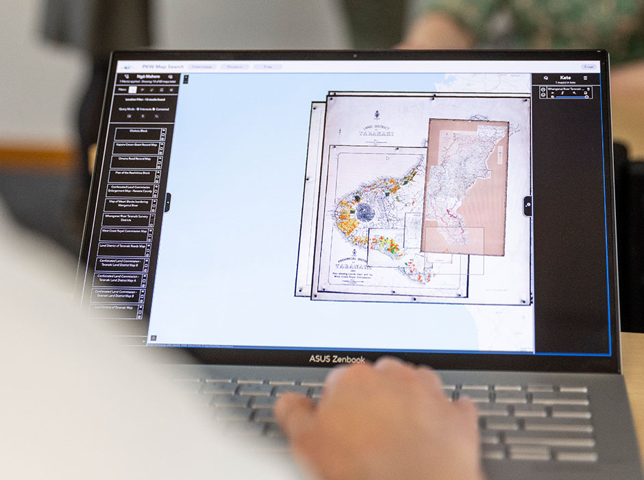
The PKW Map Web Interface. PHOTO: Graham Warman
“During that first meeting with Adrian and Puna, we understood the importance of making the maps more accessible and searchable, as well as creating a way for people to easily share their stories and experiences of the whenua,” Veronica says.
“To ensure that the project’s direction aligned with PKW’s values and vision, we followed a co-design process.”
The team, bringing to the task a diverse wealth of expertise in data science, soon found themselves on a deep and eye-opening journey of learning.
“Learning about the confusion and suffering caused by land confiscations and subsequent land amalgamations gave us a deep sense of responsibility to help PKW’s whānau learn as much as possible from their historic map images,” Caitlin says.
“It also highlighted why land names and boundaries in Taranaki have changed significantly over time.”
The collaboration presented its own technical hurdles, with the team needing to adapt existing mapping tools like ArcGIS.
“The main challenge was implementing all of the functionalities required,” Laurie says.
“While ArcGIS online has a suite of widgets that can do these functions that are all great to use, being able to customise them for our needs was difficult.”
But the efforts paid off: after six months, the partnership produced a working prototype that allows users to search a particular parcel of land and access a wealth of historic records.
It also enables users to overlay old maps onto current-day maps, which helps to confirm historical names and boundaries.
Adrian recalls being emotionally overwhelmed by what the Otago team was able to create.
“When the team first started piloting it for us, I was in tears. I was telling them, ‘I didn’t know you could do this’.”
Previously, he explains, PKW would trace where shares had come from if they could be linked to a tipuna (ancestor) listed in the 1963 amalgamation order.
“But we had difficulty showing where that whenua originally was. In most cases, we are now able to show where the land is located and, through this, help whānau to identify where their iwi and hapu and marae connections may be,” he says.
“Sometimes, they’ve been looking for this information a long time and have kept hitting brick walls – so this has been able to give them some guiding steps, to get them on the right path.”
“For me, the most rewarding part was to see how historical artefacts which were mainly inaccessible not so long ago came to life and can now support people on their journey of reconnection to their whenua.” - Dr Claudia Ott
A unique feature of the tool is an annotation function, which was initially designed to let whānau scattered around the world add stories and experiences to the maps.
But as the team began working on the feature, with which users annotate a point, line, or shape on the map with text, images or PDF files, they noticed that the names and shapes of roads, rivers and other landmarks had changed over time.
When they showed Adrian the function, he immediately saw potential to keep track of these important changes.
Later, the collaborators found another special use for it, in marking sacred places such as urupā (burial grounds) not recorded on historical maps.
“Given the Māori tradition of passing knowledge orally through waiata and storytelling, the maps, as we know it, do not capture the way the Māori people view geography and place names,” Veronica says.
“We think that the annotation feature could be an intermediate way for Māori people to incorporate their view within the unfortunately still colonial framework of maps.”
PKW is now working to protect wāhi tapu on sites that it administers itself, while assisting leaseholders of PKW-owned land where they have been identified to do the same.
Caitlin notes the prototype has been shared with tangata whenua, only through PKW, to help find and document sites of cultural significance.
“It has not been shared more widely, partly due to inaccuracies in the land records that have been uncovered by the prototype,” she says.
“Excitement has been building around its potential to uncover more sites and reconnect shareholders with their land, but we knew PKW had to be in the driver’s seat when it came to if, when, and how it was shared more widely.”
Claudia says a publication about the project – which, like Te Tātari Raraunga, was supported by funding through the Science for Technological Innovation National Science Challenge – is on its way.
She hopes it will inspire iwi elsewhere in Aotearoa New Zealand to consider the technology.
“For me, the most rewarding part was to see how historical artefacts which were mainly inaccessible not so long ago came to life and can now support people on their journey of reconnection to their whenua.”
-Kōrero by Jamie Morton, He Kitenga
This story first appeared in He Kitenga 2025 – Impacts. He Kitenga is the University of Otago’s flagship research publication, which showcases the University’s cutting-edge research and explores how it is making a difference to the lives of New Zealanders.
School of Computing
We teach, research, and innovate across all core areas of computing, solving real-world challenges and shaping the next generation of tech leaders.
View