 These deposits formed by hot water moving through rocks as the surrounding rocks were uplifted from deep (10 km) in the Earth's crust. The metals in the deposits were extracted from the surrounding rocks by dissolving trace amounts from a large volume of rocks. The metals were then deposited by sudden cooling and/or pressure change as the waters were driven by earthquakes in the Earth's crust.
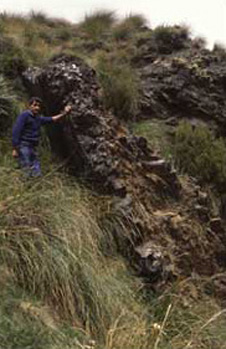
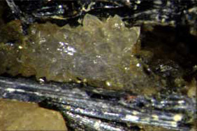
Gold-bearing quartz vein,
Shotover, Otago
Characteristic features of these deposits are:
- Gold occurs with quartz "reefs" or veins in cracks in the rock (mainly schist).
- Deposits are generally small (10 m scale), localised, irregular, and deposit locations are difficult to predict.
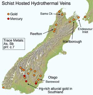
- Deposits are largely restricted to the South Island, and are scattered through Otago, Marlborough, and northern Westland.
- The Oceana Gold Ltd Macraes mine in Otago is an example of this type, as is the proposed mine at Reefton. The Sams Creek prospect (NW Nelson) has some similarities to this deposit type, but also some affinities to the other type described below.
- The deposits have high concentrations of arsenic, and often antimony, as well as gold.
- Arsenic and antimony are elevated in surface and ground waters.
- Antimony has been mined historically from some localities of this type of deposit, but never profitably.
- Rare mercury bearing deposits occur in Otago.
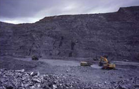
Macraes gold mine, Otago
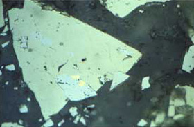
Gold (yellow dots, centre) in sulphide minerals
Stibnite, Sb2S3, from Nenthorn goldfield, Otago
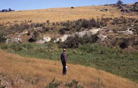
Barewood wetland
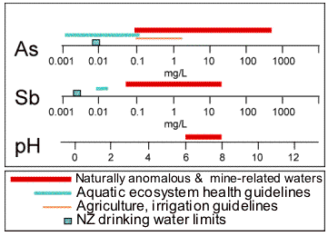 Compositions of mine waters around schist-hosted deposits (red bars) compared to drinking water limits (blue boxes).
Arsenic at Barewood mining area, east Otago
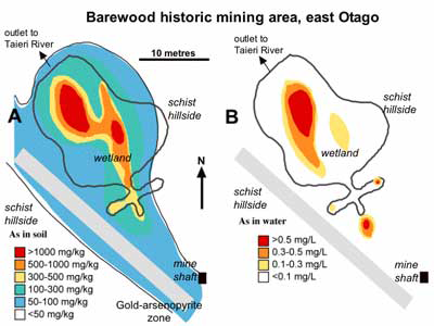 Maps of arsenic concentration in soils (left) and water (right) in the Barewood wetland.
- Historic mining of schist-hosted gold has exposed arsenic-bearing rock and discharged arsenic-bearing tailings to a stream which has now become a wetland.
- Arsenic in soil and wetland sediment is strongly elevated (to >1000 mg/kg) above regional background of 10 mg/kg.
- Dissolved arsenic concentrations reach nearly 1 mg/L in places.
- Several cows died from reputed arsenic poisoning in the area in the 1980's.
- The wetland discharges into the Taieri River, an important recreational and water supply river, but arsenic levels are low when the discharge reaches the river in normal rainfall seasons.
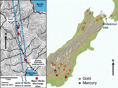
Location of Endeavour Inlet (right), and a detailed map of the area (left)
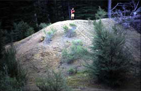
Historic antimony smelter tailings, Endeavour Inlet
Antimony at Endeavour Inlet, Marlborough
- Antimony was mined historically from schist hosted veins above Endeavour Inlet.
- Groundwater emerging from old underground mines has strongly elevated arsenic and antimony.
- Many streams and the principal river have naturally elevated As and Sb.
- Tailings from the old processing plant contain some extremely high levels of reactive arsenic and antimony minerals, and are located beside the principal river.
- The river with elevated As and Sb discharges to farmland and the Queen Charlotte Track, a popular tourist walk.
Related
Introduction
Overview: Geological setting for Metals in the New Zealand environment
- Epithermal Gold
- Mesothermal Gold
- Acid Rock drainage
- Coal
- Metals in groundwater
- Alluvial Gold
- Northland Mercury
- Hot Springs (in heavy metals)